Search

Search Results

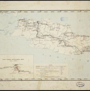
Spoor- en tramwegkaart van Java en Madoera

event1898

location_onIndonesia

The railways and tramways of Java and Madoera (Madura) are shown over two sheets of this late 19th century map, including lines in use, under construction, and being planned. An inset map shows details of a line near Batavia (Jakarta).

Atlas van Nederlandsch Oost-Indië

eventc.1897-1904

location_onIndonesia

Very detailed atlas of the entire Dutch East Indies, over 16 map sheets, with a cover and overview map. Includes topographic maps, inset maps of cities and islands, and maps featuring land and sea routes, languages, geology, colonial territory etc.

close

  • Filter from 1897 to 1898

Current results range from 1897 to 1898