Search

Search Results

Topographische kaart der residentie Soerakarta

event1867

location_onIndonesia

The residency of Soerakarta (Surakarta), Central Java, featuring crops (coffee, sugarcane, rice, sugar); warehouses (coffee, sugar, tobacco, indigo plant); factories (sugar, tobacco, indigo plant); routes (railway, postal, road).

Plattegrond der stad Soerabaija

event1867

location_onIndonesia

A mid-19th century map of the city of Soerabaija (Surabaya, East Java, Indonesia) showing its recently built defences, including the ‘Citadel Prins Hendrik’ fort and a walled moat. Outside the city are villages, plantations and fields.

Kaart van de residentie Kadoe

event1867

location_onIndonesia

The residency of Kadoe in Central Java is shown divided into two regencies (yellow border) and 12 districts (blue borders). At the left edge, there are drawings (called elevations) of the side views of the area’s mountains, marked with their heights.

Plattegrond der stad Batavia

event1866

location_onIndonesia

A mid-19th century map of the important port of Batavia (Jakarta), with its pier, commercial centre and residential streets. However, the city is also surrounded by villages (kampongs), fields and plantations. An inset map shows Batavia Castle.

Plattegrond der stad Samarang

event1866

location_onIndonesia

Mid-19th century map of the city of Samarang (Semarang, Central Java, Indonesia) dominated by the Fort Prins van Oranje. The railway station and Haven Kanal, which flows to the sea, are also prominent. The city is surrounded by villages and fields.

Kaart van Soerabaia 1866

event1866

location_onIndonesia

This map of the city of Soerabaia (modern Surabaya, East Java) shows the Mas and Pegirian rivers flowing through the city. The military fort and city streets are surrounded by wetlands, fields, plantations and villages. A 1931 reprint of an 1866 map.

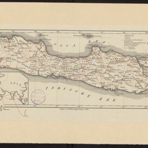
Nederlandsch Oost-Indië

event1865

location_onBrunei, Cambodia, East Timor, Indonesia, Laos, Malaysia, Myanmar, Vietnam, Thailand, Southeast Asia, Singapore, Philippines, Papua New Guinea

This detailed map of the Dutch East Indies in the mid-19th century contains a great deal of information: topographical details, settlements and administrative areas, roads, railways and maritime routes, telegraph lines, inset maps etc.

Kaart van Batavia omstreeks honderdvÿfentwintigjaren geleden overgebragt in het jaar 1864

event1864

location_onIndonesia

Although published in the mid-19th century, this map is based on Batavia (Jakarta) in c.1740. It focuses on the city’s castle and streets (in red), but also shows the fields of crops and the wetlands surrounding the city (in blue).

Situatie-teekening van het Haven-kanaal

event1864

location_onIndonesia

Plan of the pier at the port of Batavia (Jakarta). Lines indicate the changing position of the beach and the sandbank over the years, and numbers show the water depth (red numbers=measured in the year 1823, blue=1831 and black=1864).

Situatie-teekening van de havendammen te Batavia

event1864

location_onIndonesia

Plan of the pier at the port of Batavia (Jakarta). Lines indicate the changing position of the beach and the sandbank over the years, and numbers show the water depth (red numbers=measured in the year 1823, blue=1831 and black=1864).

Eiland Java: aanwijzing der geprojecteerde Spoorweglijnen

event1863

location_onIndonesia

The thick black lines on this map represent proposed routes for new railway lines in mid-19th century Java. The island is divided into administrative regions, with significant mountains and rivers marked.

Java

event1863

location_onIndonesia

Map of Java divided into Dutch administrative areas (‘residencies’), with roads and paths in red. An inset map shows the route used to send mail from Europe to the East Indies.

close