Search

Search Results

Route chart to India and the East

event1895

location_onBrunei, Cambodia, East Timor, Indonesia, Laos, Malaysia, Myanmar, Philippines, Singapore, Southeast Asia, Thailand, Vietnam

Map of Asia featuring steamship routes—including around Southeast Asia—connecting ports such as Penang, Singapore, Batavia (Jakarta), Saigon, Bangkok, Rangun (Yangon), Manila, Macassar (Makassar) etc. There is also an inset map of Singapore.

Malay, or East Indian Archipelago, with Burmah, Siam &c.

event1887

location_onBrunei, Cambodia, East Timor, Indonesia, Laos, Malaysia, Myanmar, Philippines, Singapore, Southeast Asia, Thailand, Vietnam

On this map of Southeast Asia, numerous small islands, shoals and reefs are marked and named, especially in the South China Sea and around the Sunda and Maluku islands. Submarine cables to carry telegraph messages around the region are also shown.

A sketch map of the East Indian possessions of the Netherlands

event1886

location_onBrunei, Indonesia, Malaysia, Papua New Guinea, Philippines, Singapore

Produced by the Intelligence Branch of the British War Office, this map shows Dutch colonial territories in maritime Southeast Asia, and their political and military divisions in Java and Madura. British and Spanish territories are also marked.

Die Ostindischen Inseln

event1846

location_onBrunei, Cambodia, East Timor, Indonesia, Laos, Malaysia, Myanmar, Philippines, Singapore, Southeast Asia, Thailand, Vietnam

Map of Southeast Asia highlighting the colonial possessions of the Netherlands (Dutch East Indies), Spain (Philippines), Britain (Straits Settlements, Burma, part of Borneo) and Portugal (East Timor). From the German atlas ‘Stielers Handatlas’.

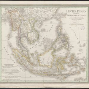
Hinter Indien nebst den Hinterindischen Inseln

event1836

location_onCambodia, East Timor, Indonesia, Laos, Malaysia, Myanmar, Brunei, Philippines, Singapore, Southeast Asia, Thailand, Vietnam

Coloured borders identify the colonial possessions of Britain, the Netherlands, Spain, Denmark and Portugal in mid-19th century Southeast Asia. Cities are marked with symbols indicating population, and military forts are marked with star symbols.

Hinter Indien nebst den Hinterindischen Inseln

event1836

location_onBrunei, Cambodia, East Timor, Indonesia, Laos, Malaysia, Myanmar, Philippines, Singapore, Southeast Asia, Thailand, Vietnam

Coloured borders identify the colonial possessions of Britain, the Netherlands, Spain, Denmark and Portugal in mid-19th century Southeast Asia. Cities are marked with symbols indicating population, and military forts are marked with star symbols.

Asien 1831

event1831

location_onBrunei, Cambodia, East Timor, Indonesia, Laos, Malaysia, Myanmar, Papua New Guinea, Philippines, Singapore, Southeast Asia, Thailand, Vietnam

On this map of Asia, borders are outlined and cities underlined in different colours to show the colonial territories of the European powers: Russian, British, Dutch, French, Spanish, Portuguese and Danish.

Asien nach den neusten und besten Hülfsmitteln entworffen und herausgegeben im Jahre 1793

event1793

location_onBrunei, Cambodia, East Timor, Indonesia, Laos, Malaysia, Myanmar, Papua New Guinea, Philippines, Singapore, Southeast Asia, Thailand, Vietnam

On this map of Asia, borders are outlined and cities underlined in different colours to show the colonial territories of the European powers: e.g. at this time, Benkulen (Bencoolen) on the west coast of Sumatra is British, and Malacca is Dutch.

close

  • Filter from 1793 to 1895

Current results range from 1793 to 1895