Search

Search Results

Kaart van Zuid Celebes met uitzondering van het rijk Gowa

event1890

location_onIndonesia

Detailed topographical map of South Celebes (Sulawesi) spread over four sheets, featuring crops (coffee, alang-alang, rice), fishing ponds, salt panning. With two additional maps of the island of Saleijer (Selayar) and Pitoempanoewae (Pitumpanua).

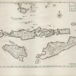
Kaart der Zuyd-Wester Eylanden van Banda

eventc.1724-1726

location_onEast Timor, Indonesia

Although this map’s title refers to the south-western islands of the Banda Islands, it actually focuses on the Lesser Sunda Islands, including Flores, Sumba and Timor. The islands feature mountains and jungle, with shoals and reefs around the coasts.

close

  • Filter from 1724 to 1890

Current results range from 1724 to 1890