
Search Results

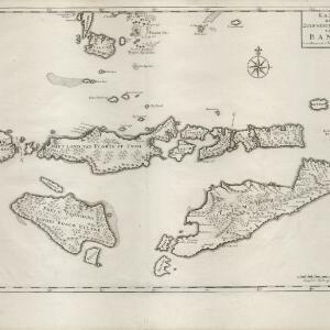
Kaart der Zuyd-Wester Eylanden van Banda
c.1724-1726
East Timor, Indonesia
Although this map’s title refers to the south-western islands of the Banda Islands, it actually focuses on the Lesser Sunda Islands, including Flores, Sumba and Timor. The islands feature mountains and jungle, with shoals and reefs around the coasts.


Isole Molvcche
1605
Brunei, Cambodia, Indonesia, Laos, Malaysia, Philippines, Singapore, Southeast Asia, Thailand, Vietnam, East Timor
This map shows some inaccuracies, especially in the shape of the Malay Peninsula and the islands meant to represent Sumatra (labelled ‘Camatra’), Java (‘Iava Mazor’) and Borneo (‘Iava Menor’). Latin text describes the Maluku Islands.


