Search Results

Kaart van de Afdeeling Deli der residentie Oostkust van Sumatra
1887
Indonesia
A map of the department of Deli, Java, divided into administrative districts, and spread over eight sheets. Rivers, railways, roads and paths, forests and mountains, and crops—rice, coconut, pepper, nutmeg, alang-alang—are marked.

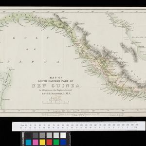
Map of South Eastern part of New Guinea: to illustrate the explorations of Rev. J. Chalmers, L.M.S.
1887
Papua New Guinea
Map of the southeast coast of British New Guinea, divided into administrative regions, with the northern regions left mostly blank. Based on the explorations of the Scottish missionary James Chalmers.


