Search

Search Results

Map of Singapore and surrounding country

event1896

location_onSingapore, Malaysia, Indonesia

Map of Singapore Island, including the surrounding islands and straits, and southern Johor. Lighthouses are marked in red and yellow, including Horsburgh Lighthouse on Pedra Branca, Raffles Lighthouse and Fort Canning Lighthouse.

Districts Bhamo and Myitkyina

event1896

location_onMyanmar

Map of two districts in northern Burma (Myanmar) featuring the Irrawaddy River, the Burma State Railway (and others under construction), and mines (ruby, amber, jade). High points are marked with their heights so they can be used for triangulation.

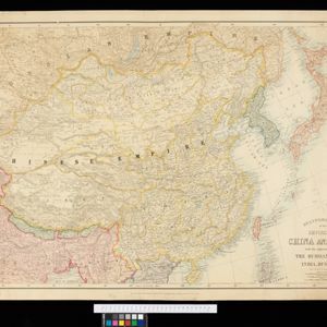
Stanford's Map of the Empires of China & Japan with the adjacent parts of the Russian Empire, India, Burma &c.

event1896

location_onMyanmar, Vietnam

The most northern part of Southeast Asia is shown on this map of China and Japan, with Burma (Myanmar) and Tong-King (Vietnam) appearing at the bottom of the map. Mountains, rivers and settlements are marked, as well as a railway line in Burma.

Sketch map of the Malay States, Kelantan and Trengganu, to illustrate the Paper by Hugh Clifford

event1896

location_onMalaysia

Map of the east coast of the Malay Peninsula, showing the route taken along the rivers and coast by Hugh Clifford, who was the British Resident at Pahang at the time. In addition to rivers, significant mountains and settlements are marked.

close