Search

Search Results

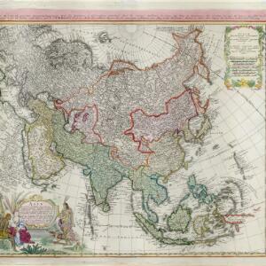
Asia secundum legitimas projectionis stereographicae regulas et juxta recentissimas observation et relationes = Carte de l'Asie, projettée stereographiquement, tirée des relations et observations

event1744

location_onBrunei, Cambodia, East Timor, Indonesia, Laos, Malaysia, Myanmar, Philippines, Singapore, Southeast Asia, Thailand, Vietnam

This mid-18th century map of Asia has a stereographic projection to aid in navigation. There is also an illustration featuring two Asian men depicted as warriors, with a robed woman, as well as a large lizard.

A new map of East India

event1676

location_onBrunei, Cambodia, East Timor, Indonesia, Laos, Malaysia, Myanmar, Philippines, Singapore, Southeast Asia, Thailand, Vietnam

This colourful 17th century map highlights the mountain ranges and rivers of Southeast Asia and India. The cartouche features an illustration of Asian men wearing brightly-coloured clothing and carrying bows and arrows.

Asiæ nova delineatio

eventc.1656-1677

location_onBrunei, Cambodia, East Timor, Indonesia, Laos, Malaysia, Myanmar, Philippines, Singapore, Southeast Asia, Thailand, Vietnam

This colourful mid-17th century map was originally published in the Dutch cartographer Nicolaes Visscher's ‘Atlas contractus’. The map is dedicated to D. Henry Spiegel, consul and senator of the city of Amsterdam, and features his coat of arms.

close

  • Filter from 1656 to 1744

Current results range from 1656 to 1744