Search

Search Results

Malay, or East Indian Archipelago, with Burmah, Siam &c.

event1887

location_onBrunei, Cambodia, East Timor, Indonesia, Laos, Malaysia, Myanmar, Philippines, Singapore, Southeast Asia, Thailand, Vietnam

On this map of Southeast Asia, numerous small islands, shoals and reefs are marked and named, especially in the South China Sea and around the Sunda and Maluku islands. Submarine cables to carry telegraph messages around the region are also shown.

Kaart van het eiland Bawean

event1886

location_onIndonesia

Topographic map of the island of Bawean in the Java Sea, with terrain shown by contour lines, and mountains labelled with their heights. Villages, forests (heavy, light, teakwood) and crops (coconut, coffee, alang-alang, rice, bamboo) are marked.

Figuratieve kaart van de residentie Palembang

event1885

location_onIndonesia

A hand drawn map of the province of South Sumatra, divided into administrative districts, and including the capital city of Palembang. Mountains and rivers are featured prominently, with a list at the top left indicating the heights of the mountains.

Map of South-Eastern Asia and Northern Australia: showing the districts in Annam and Tonquin which France proposes to annex and to place under a Protectorate, the portion of New Guinea proposed to be acquired by Queensland, and the districts affected by the volcanic eruptions in Java

event1883

location_onSoutheast Asia, Singapore, Thailand, East Timor, Vietnam, Brunei, Cambodia, Indonesia, Laos, Malaysia, Myanmar, Papua New Guinea, Philippines

This 1883 map shows European colonial territories in Southeast Asia. An inset map details the proposed French annexation of Tonquin, Annam and Cochin China (modern Vietnam). International telegraph lines are also marked.

Topographische kaart der residentie Batavia

eventc.1882-1883

location_onIndonesia

The residency of Batavia, West Java, featuring plantations (coffee, tea, coconut, cinnamon, nutmeg, sugar); crops (rice, alang-alang, bamboo); fishing ponds; factories, warehouses, shops; routes, administrative borders; mountains, rivers, lakes.

Kaart van het westelijk gedeelte van den Indischen Archipel

event1883

location_onIndonesia, Malaysia, Singapore

The shaded area on this map is where volcanic ash fell from the 1883 eruption of Krakatoa (Sunda Strait between Sumatra and Java). Red figures record the thickness of the ash in millimetres; black figures are distance from the eruption in kilometres.

Kaart van Java

event1878

location_onIndonesia

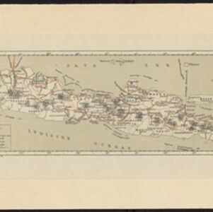
Map of Java divided into administrative areas (‘residencies’). Telegraph lines, railways (including those under construction) and postal routes are marked. Around the coasts, the routes of steamships are shown, with journey distances in miles.

Kaart van Java

event1878

location_onIndonesia

Map of Java divided into administrative areas (‘residencies’). Telegraph lines, railways (including those under construction) and postal routes are marked. Around the coasts, the routes of steamships are shown, with journey distances in miles.

Java en Madoera

event1875

location_onIndonesia

This detailed late 19th century map shows Java and Madura divided into regencies, and features mountains, roads, railways, and rivers.

Java en Madoera

event1873

location_onIndonesia

This detailed late 19th century map shows Java and Madura divided into regencies, and features mountains, roads, railways, and rivers.

Geognostisch-Mijnbouwkundige Kaart van het Eiland Bangka, Distrikt Toboali

event1872

location_onIndonesia

This geological map of the district of Toboali (Bangka Island, east of Sumatra) uses colours to depict types of rocks, soils and minerals. Tin mining areas are also highlighted.

Nederlandsch Oost-Indie

event1867

location_onBrunei, East Timor, Indonesia, Malaysia, Philippines, Singapore, Thailand

Map of the Dutch East Indies, divided into administrative regions with coloured borders. There is an inset map of the important port city of Batavia (Jakarta) and its surroundings.

close