Search

Search Results

Carte générale de l'Océan Pacifique

event1845

location_onBrunei, Cambodia, East Timor, Indonesia, Laos, Malaysia, Myanmar, Papua New Guinea, Philippines, Singapore, Southeast Asia, Thailand, Vietnam

Marine chart of the Pacific Ocean, including Southeast Asia. Small islands, shoals and reefs are marked, and often named, around the seas and straits of the region.

La Presqu'isle de l'Inde au delà du Gange, avec l'Archipel des Indes. Partie occidentale

event1785

location_onBrunei, Cambodia, Indonesia, Laos, Malaysia, Myanmar, Singapore, Thailand, Vietnam

In the 18th century, European maps tended to use their own country’s meridian, so on this French map of Southeast Asia longitude is measured from the Paris Meridian. Eleven different scales are also shown.

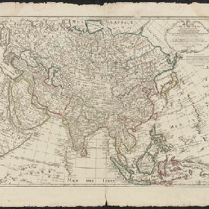
Carte d'Asie divisée en ses principaux etats

event1776

location_onMyanmar, Papua New Guinea, Philippines, Singapore, Southeast Asia, Thailand, Vietnam, Malaysia, Laos, Indonesia, East Timor, Cambodia, Brunei

The 20 colourful illustrations around the border of this 18th century map of Asia depict a variety of historical and biblical scenes, including the Crucifixion of Jesus and the sacking of Troy. Each scene has a description in French and Spanish.

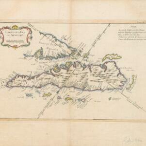
Carte de l'Isle de Sumatra

event1764

location_onMalaysia, Indonesia, Singapore

This mid-18th century map shows the island of Sumatra and the Malay Peninsula, divided by the Straits of Malacca. A note in French at the top right corner states that the interior of Sumatra and the course of its rivers are unknown.

Carte d'Asie: dressée sur les memoires envoyéz par le Czar a l'Academie Royale des Science

eventc.1750

location_onBrunei, Cambodia, East Timor, Indonesia, Laos, Malaysia, Myanmar, Philippines, Singapore, Southeast Asia, Thailand, Vietnam

An early 18th century map of Asia by the French cartographer Guillaume Delisle (1675–1726). Regions are indicated with coloured borders, and the southern part of Borneo is labelled ‘Côte de Mahometans [Coast of the Muslims]’.

Les Indes oriental et leur archipel: aßujetties aux observations astronomiques

event1750

location_onBrunei, Cambodia, East Timor, Indonesia, Laos, Malaysia, Myanmar, Philippines, Singapore, Southeast Asia, Thailand, Vietnam

This mid-18th century map of Asia has colour-coded regions, with mainland Southeast Asia and the Greater Sunda Islands bordered in blue, and India in red.

Les Isles de la Sonde

event1749

location_onBrunei, Indonesia, Malaysia, Singapore

This colourful mid-18th century map of the Sunda Isles (‘Isles de la Sonde’) includes the Malay Peninsula in addition to Sumatra, Java and Borneo. Mountain ranges and jungles are shown pictorially, and the islands and coasts feature shoals and reefs.

Carte d'Asie: dressée sur les memoires envoyéz par le Czar a l'Academie Royale des Science

event1745

location_onBrunei, Cambodia, East Timor, Indonesia, Laos, Malaysia, Myanmar, Philippines, Singapore, Southeast Asia, Thailand, Vietnam

An early 18th century map of Asia by the French cartographer Guillaume Delisle (1675–1726). Regions are indicated with coloured borders, and the southern part of Borneo is labelled ‘Côte de Mahometans [Coast of the Muslims]’.

Carte d'Asie: dressée sur les memoires envoyéz par le Czar a l'Academie Royale des Science

event1723

location_onBrunei, Cambodia, East Timor, Indonesia, Laos, Malaysia, Myanmar, Singapore, Philippines, Southeast Asia, Thailand, Vietnam

An early 18th century map of Asia by the French cartographer Guillaume Delisle (1675–1726). Regions are indicated with coloured borders, and the southern part of Borneo is labelled ‘Côte de Mahometans [Coast of the Muslims]’.

Carte d'Asie: dressée sur les memoires envoyéz par le Czar a l'Academie Royale des Science

eventc.1722-1774

location_onBrunei, Cambodia, East Timor, Indonesia, Laos, Malaysia, Myanmar, Philippines, Singapore, Southeast Asia, Thailand, Vietnam

An early 18th century map of Asia by the French cartographer Guillaume Delisle (1675–1726). Regions are indicated with coloured borders, and the southern part of Borneo is labelled ‘Côte de Mahometans [Coast of the Muslims]’.

close