Search Results

Malay, or East Indian Archipelago, with Burmah, Siam &c.
1887
Brunei, Cambodia, East Timor, Indonesia, Laos, Malaysia, Myanmar, Philippines, Singapore, Southeast Asia, Thailand, Vietnam
On this map of Southeast Asia, numerous small islands, shoals and reefs are marked and named, especially in the South China Sea and around the Sunda and Maluku islands. Submarine cables to carry telegraph messages around the region are also shown.

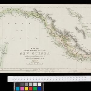
Map of South Eastern part of New Guinea: to illustrate the explorations of Rev. J. Chalmers, L.M.S.
1887
Papua New Guinea
Map of the southeast coast of British New Guinea, divided into administrative regions, with the northern regions left mostly blank. Based on the explorations of the Scottish missionary James Chalmers.

W. & A.K. Johnston's sheet of maps to illustrate the Caroline islands dispute between Germany and Spain
1885
Southeast Asia, Papua New Guinea, Indonesia, Philippines, Malaysia, East Timor
Three maps of the Caroline Islands. One shows colonised areas in Southeast Asia: Dutch East Indies; British North Borneo, British New Guinea; German New Guinea; Philippines (Spain); Portuguese Timor. The route of the Challenger expedition is marked.

Reduzirte Karte von den Philippinen und den Sulu Inseln
1884
Philippines, Malaysia, Indonesia
Maritime map of the Philippines, with inset maps of bays showing bathymetry (sea depth), shoals, reefs and anchor points. There is also an inset map of Taal Volcano, and elevations (side views of terrestrial landmarks like mountains and islands).

Westkust Borneo: Mond der Padang-Tikar rivier
1884
Indonesia
Navigation map of the mouth of the Padang Tikar River, on the west coast of Borneo, featuring bathymetric (water depth) routes. Obstructions are marked with letters: ‘m’ (mud), ‘z’ (sand). Trees, hills and fishermen’s houses are shown as landmarks.
- Filter from 1565 to 1900
- Indonesia481
- Malaysia305
- Singapore266
- Brunei245
- Vietnam240
- Thailand239
- Cambodia231
- Philippines229
- Myanmar223
- Laos218
- East Timor205
- Southeast Asia190
- more Simple Location »
- River434
- Road108
- Path45
- Postal Route22
- Telegraph/Telephone21
- Railway/Tramway19
- Bridge11
- Canal10
- [remove]Mountain/Volcano544
- Jungle/Wooded Area133
- Wetlands86
- Wild Animals46
- Mangrove15


