
Search Results
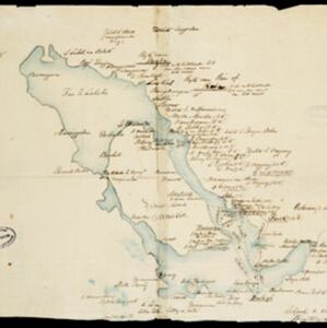
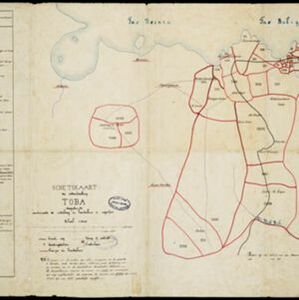
Schetskaart der onderafdeeling Toba: aantoonende de verdeeling in hoendoelans of negorijen
1886
Indonesia
Hand-drawn map of the district of Toba at the southern shore of Lake Toba, Sumatra, further divided into administrative areas (details of which are listed). Roads and paths are marked, and there are two missionary buildings indicated with crosses.


