Search

Search Results

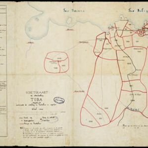
Schetskaart der onderafdeeling Toba: aantoonende de verdeeling in hoendoelans of negorijen

event1886

location_onIndonesia

Hand-drawn map of the district of Toba at the southern shore of Lake Toba, Sumatra, further divided into administrative areas (details of which are listed). Roads and paths are marked, and there are two missionary buildings indicated with crosses.

Kaart van Atjeh en Onderhoorigheden

event1886

location_onIndonesia

This map of the Atjeh and its surrounding area (modern province of Aceh, Indonesia) is divided into administrative areas. There is an inset map of the capital city Kota Radja (Banda Aceh), and mountains (with their height) and rivers are marked.

Kaart van Zuid Celebes met uitzondering van het Rijk Gowa

event1886

location_onIndonesia

Map of the South Peninsula of Celebes (Sulawesi), spread over four sheets. It features crops (alang-alang, coffee, rice, sugarcane), fishing ponds, salt panning, routes, mountains, forests and settlements. The Gowa Regency is left blank.

close