Search Results
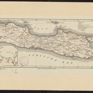
Topographische kaart der residentie Bagelen
1860
Indonesia
The residency of Bagelen, Central Java, is shown divided into regencies and districts. Coffee, tea and cinnamon plantations, fields of rice, alang-alang and other crops, mountains, rivers, hot and mineral springs, settlements and routes are marked.
- Dutch East Indies92
- Java88
- Java Sea16
- Java Zee14
- Madura14
- Batavia9
- Jakarta9
- Celebes8
- Sulawesi8
- Sumatra8
- Madura Strait7
- Semarang7
- more Detailed Location »
- Kampong/Village71
- Post Office47
- Residential Area39
- Cemetery/Columbarium23
- Military Fort20
- Church13
- Temple12
- Mosque10
- Hospital9
- Military Barracks8
- Jail/Prison7
- Public Space7
- Well6
- Court of Law5
- more Settlement Features »
- [remove]Postal Route98
- Road90
- River87
- Path73
- Railway/Tramway36
- Canal16
- Telegraph/Telephone12
- Bridge3
- Cronenberg, F.20
- Versteeg, W.F.20
- Wolff18
- Frühling, P.7
- Böhm5
- Melvill van Carnbee, Pieter5
- Ostreig5
- Bajetto, G.F.M.4
- more Map Maker »
- Topographische Inrichting36
- Van Haren Noman & Kolff22
- A.J. Bogaerts12
- D. Heyse10
- Topographische Bureau8
- Seyffardt's Boekhandel4
- Emrik & Binger3
- Jos. Smulders & Co.3
- more Printer/Publisher »
- The Hague47
- Batavia36
- Amsterdam6
- Breda2
- Semarang2
- Zutphen2
- Bandung1
- Leiden1
- more Place of Publication »