Search

Search Results

Districts Bhamo and Myitkyina

event1896

location_onMyanmar

Map of two districts in northern Burma (Myanmar) featuring the Irrawaddy River, the Burma State Railway (and others under construction), and mines (ruby, amber, jade). High points are marked with their heights so they can be used for triangulation.

Upper Burma: With additions and corrections to 1896

event1896

location_onMyanmar

Map of Upper Burma divided into Divisions and Districts, and featuring the Irrawaddy and Chindwin rivers, the Burma State Railway, and settlements including the city of Mandalay.

India shewing railways with stations

event1896

location_onMyanmar

This map focuses on India, but also includes Burma (Myanmar), showing the country’s railway lines with their stations, including engine changing stations and junction stations. Part of a series of maps charting the development of the railway system.

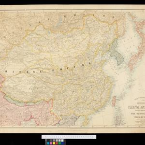
Stanford's Map of the Empires of China & Japan with the adjacent parts of the Russian Empire, India, Burma &c.

event1896

location_onMyanmar, Vietnam

The most northern part of Southeast Asia is shown on this map of China and Japan, with Burma (Myanmar) and Tong-King (Vietnam) appearing at the bottom of the map. Mountains, rivers and settlements are marked, as well as a railway line in Burma.

India shewing railways

event1896

location_onMyanmar

This map of India and Burma (Myanmar) shows railways, and railways sanctioned or under construction. Other maps in this series show the same area in different years of the 1890s.

Upper Burma

event1895

location_onMyanmar, Thailand

Map of Upper Burma, showing the borders with Assam (India), China and Siam (Thailand), as well as internal administrative borders. Mountains with their heights, settlements, rivers and railways (completed, proposed and under construction) are shown.

Stanford's Map of the Empires of China & Japan with the adjacent parts of the Russian Empire, India, Burma &c.

event1895

location_onMyanmar, Vietnam

The most northern part of Southeast Asia is shown on this map of China and Japan, with Burma (Myanmar) and Tong King (Vietnam) appearing at the bottom of the map. Mountains, rivers and settlements are marked, as well as a railway line in Burma.

India shewing railways

event1895

location_onMyanmar

This map of India and Burma (Myanmar) shows railways, and railways sanctioned or under construction. Other maps in this series show the same area in different years of the 1890s.

Plan of the town and suburbs of Rangoon

eventc.1895-1897

location_onMyanmar

Detailed plan of the city of Rangoon (Yangon, Myanmar) with commercial, religious, government and military buildings, surrounded by lakes, fields of crops and villages. Someone has drawn details on the map of areas that have undergone ‘levelling’.

Upper Burma

event1894

location_onMyanmar, Thailand

Map of Upper Burma, showing the borders with Assam (India), China and Siam (Thailand), as well as internal administrative borders. Mountains with their heights, settlements, rivers and railways (completed, proposed and under construction) are shown.

Upper Burma: With additions and corrections to January 1894

event1894

location_onMyanmar

Map of Upper Burma divided into Divisions and Districts, and featuring the Irrawaddy and Chindwin rivers, the Burma State Railway, and settlements including the city of Mandalay.

close