Search

Search Results

Kaart van Nederlandsch-Indie

event1893

location_onBrunei, Cambodia, Indonesia, Malaysia, Singapore, Thailand, Vietnam, East Timor, Philippines, Southeast Asia

Shipping routes are the focus of this map of the Dutch East Indies, indicated by red lines labelled with the name of the shipping company and the destinations. Parcel shipping routes are also shown. Inset maps feature railway lines too.

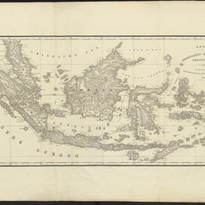
Kaart van Nederlands Oostindische bezittingen

event1843

location_onMalaysia, Singapore, Indonesia, East Timor

Map of Dutch colonial possessions in maritime Southeast Asia, labelled with the names of administrative areas. Mountains are represented by hachures, short lines/dashes that give a sense of the shape and steepness of terrain.

close

  • Filter from 1843 to 1893

Current results range from 1843 to 1893