Search

Search Results

Die Ostindischen Inseln

event1846

location_onBrunei, Cambodia, East Timor, Indonesia, Laos, Malaysia, Myanmar, Philippines, Singapore, Southeast Asia, Thailand, Vietnam

Map of Southeast Asia highlighting the colonial possessions of the Netherlands (Dutch East Indies), Spain (Philippines), Britain (Straits Settlements, Burma, part of Borneo) and Portugal (East Timor). From the German atlas ‘Stielers Handatlas’.

Carte Plate du Golfe de Siam: avec une partie des Côtes de Malaye et de Camboje, depuis l'Isle Timon, jusqu'à celle Condor

event1775

location_onCambodia, Malaysia, Thailand

Map of the Gulf of Siam (Gulf of Thailand) with shoals and small islands marked. The web of lines is a rhumbline network, while the numbers indicate sea depth (bathymetry), both used to aid navigation. There is an inset map of the Redang Archipelago.

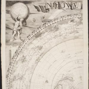
Platte globus van hemel en aarde noyt alsoo gesien waar op heel licht kan geleert worden d'loop des hemels en zee-vaart op alle polus-hooghten

event1697

location_onBrunei, Cambodia, Indonesia, Laos, Malaysia, Myanmar, Philippines, Southeast Asia, Thailand, Vietnam, Singapore, East Timor

A richly illustrated circular map of the world, surrounded by a ring of stars and sky, and spread over four sheets. The corners contain drawings of Atlas and Hercules holding the Earth on their shoulders, and of various philosophers and astronomers.

close

  • Filter from 1697 to 1846

Current results range from 1697 to 1846