Search Results

Prèsqu'ile de Malacca
1827
Malaysia, Indonesia, Singapore
By Belgian geographer Philippe Vandermaelen (1795–1869), this 19th century map of the Malay Peninsula also features the Riau Islands—including the Anambas and Natuna islands in the South China Sea—the Straits of Malacca and the Singapore Strait.

Royaume de Siam, avec les Royaumes qui luy sont Tributaires, et les Isles de Sumatra, Andemaon etc.
1742
Brunei, Cambodia, Indonesia, Laos, Malaysia, Myanmar, Singapore, Thailand, Vietnam
Map marking the routes through maritime Southeast Asia of two delegations: a French delegation from Brest, France to Siam in 1685; and a Siamese delegation from Siam to Brest in 1686. A note next to Aceh records a sea battle against Portugal in 1616.

Le Détroit de Malacca: dressé sur les memoires des plus savans Voyageurs modernes
c.1700-1799
Malaysia, Indonesia, Singapore
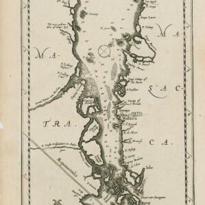
This 18th century map was designed to aid navigation through the Strait of Malacca between Sumatra and the Malay Peninsula. Shoals, reefs and islands are marked, and the numbers printed on the strait record sea depth (bathymetry).


