Search Results

Physical chart of the Indian Ocean: shewing the temperature of the water, the currents of the air and ocean, directions of the wind, districts of hurricanes, regions of the monsoons & ty-foons, trade routes &c&c.
1849
Brunei, Cambodia, East Timor, Indonesia, Laos, Malaysia, Myanmar, Papua New Guinea, Philippines, Singapore, Southeast Asia, Thailand, Vietnam
Chart of the Indian Ocean, showing climate and weather-related data, including around the seas and straits of Southeast Asia where trade routes are marked, along with monsoon and typhoon regions, and currents during the different monsoon seasons.

[Sumatra and the Strait of Malacca]
c.1800
Malaysia, Singapore, Indonesia
Chart of maritime Southeast Asia, showing bathymetry (sea depth), islands, shoals, reefs, landmarks, and notes (‘Rock seen at Low Water’), all to aid navigation. A rhumbline network has been drawn on the map in pencil. Only one sheet is present.

Carte hydro-geo-graphique des Indes orientales, en deca̧ et au dela du Gange avec leur archipel
1771
Brunei, Cambodia, East Timor, Indonesia, Laos, Malaysia, Myanmar, Philippines, Singapore, Southeast Asia, Thailand, Vietnam
The arrows on this map show the direction of the seasonal monsoons of Southeast Asia during the late 18th century. Each arrow has a label in French, indicating the month. The hatched sea areas are where the winds always blow in the same direction.

Presqu'Isle de l'Inde au dela du Gange, ou sont les Rmes. d'Ava, de Siam, de Tong-King, de Cochinchine, de Camboge &c.
c.1770-1779
Brunei, Cambodia, Indonesia, Laos, Malaysia, Myanmar, Singapore, Thailand, Vietnam
On this late 18th century map, the modern nation states of mainland Southeast Asia can be seen emerging: Myanmar (here labelled Ava), Laos, Vietnam (Tong-King and Cochinchine), Cambodia (Camboge), Thailand (Siam) and Malaysia (Malaca).

Tabula Indiæ Orientalis et regnorum adjacentium
1724
Brunei, Cambodia, East Timor, Indonesia, Laos, Malaysia, Myanmar, Philippines, Singapore, Southeast Asia, Thailand, Vietnam
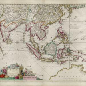
Colourful map of the East Indies focusing on maritime navigation: there is a compass rose at the centre of a rhumbline network (a web of lines to help plot routes). Shoals, reefs and islands are also marked.

Partie de la nouvelle Grande Cartes des Indes Orientales, contenant les Isles Maldives, Ceylan, Malacca, Sumatra &c.
1700
Indonesia, Malaysia, Singapore, Thailand
Sumatra and the Malay Peninsula feature on this map of the Indian Ocean. Enganno Island, west of southern Sumatra, has a label that translates as ‘inhabited by very pernicious savages’. An inset map depicts the Madura Strait between Java and Madura.

Indiae orientalis, nec non insularum adiacentium
1698
Myanmar, Philippines, Singapore, Southeast Asia, Thailand, Vietnam, Malaysia, Laos, Indonesia, East Timor, Cambodia, Brunei
The cartouche on this map of Asia is decorated with a colourful painting illustrating the region’s commerce, with Asian merchants displaying an assortment of goods, including jewellery, porcelain vessels and figurines, textiles and exotic animals.

Isole dell'Indie divise in Filippine, Molucche e della Sonda
c.1691-1696
Brunei, Cambodia, East Timor, Indonesia, Laos, Malaysia, Myanmar, Philippines, Singapore, Southeast Asia, Thailand, Vietnam
Dotted lines and colours divide maritime Southeast Asia into three regions on this map: the Philippine archipelago, Maluku Islands and Sunda Islands. The cartouche features cherub mermaids carrying a banner and shield.
- [remove]Indian Ocean16
- Sumatra16
- Borneo13
- Java11
- Malay Peninsula11
- Sulawesi10
- Celebes8
- Pegu6
- East Indies5
- Java Sea5
- Siam5
- South China Sea5
- more Detailed Location »


