Search

Search Results

Atlas van Nederlandsch Oost-Indië

eventc.1897-1904

location_onIndonesia

Very detailed atlas of the entire Dutch East Indies, over 16 map sheets, with a cover and overview map. Includes topographic maps, inset maps of cities and islands, and maps featuring land and sea routes, languages, geology, colonial territory etc.

Kaart van Zuid Celebes met uitzondering van het rijk Gowa

event1890

location_onIndonesia

Detailed topographical map of South Celebes (Sulawesi) spread over four sheets, featuring crops (coffee, alang-alang, rice), fishing ponds, salt panning. With two additional maps of the island of Saleijer (Selayar) and Pitoempanoewae (Pitumpanua).

Kaart van zuid Celebes mit uitzondering van het rijk Gowa

event1888

location_onIndonesia

Map of the South Peninsula of Celebes (Sulawesi), spread over four sheets. It features crops (alang-alang, coffee, rice, sugarcane), fishing ponds, salt panning, routes, mountains, forests and settlements. The Gowa Regency is left blank.

Kaart van Zuid Celebes met uitzondering van het Rijk Gowa

event1886

location_onIndonesia

Map of the South Peninsula of Celebes (Sulawesi), spread over four sheets. It features crops (alang-alang, coffee, rice, sugarcane), fishing ponds, salt panning, routes, mountains, forests and settlements. The Gowa Regency is left blank.

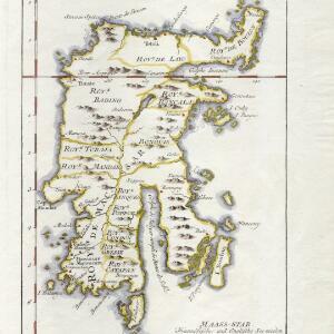
Carte de l'isle Celebes ou Macassar

event1763

location_onIndonesia

This mid-18th century map of Celebes (Sulawasi) shows the island divided into approximately a dozen separate kingdoms. The Gulf of Saleyer is noted as being ‘rempli de Bancs de Sable [filled with sandbanks]’.

close