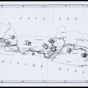
Eiland Java: aanwijzing der geprojecteerde Spoorweglijnen
event1863
location_onIndonesia
The thick black lines on this map represent proposed routes for new railway lines in mid-19th century Java. The island is divided into administrative regions, with significant mountains and rivers marked.
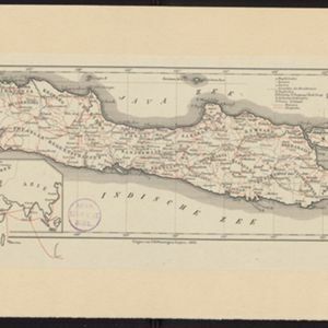
Java
event1863
location_onIndonesia
Map of Java divided into Dutch administrative areas (‘residencies’), with roads and paths in red. An inset map shows the route used to send mail from Europe to the East Indies.
Eiland Java: aanwijzing der geprojecteerde Spoorweglijnen
event1863
location_onIndonesia
The thick black lines on this map represent proposed routes for new railway lines in mid-19th century Java. The island is divided into administrative regions, with significant mountains and rivers marked.