Search Results

A new chart of the eastern straits to China drawn from the best authorities
1800
Indonesia
Two maps of routes around the Flores and Banda seas—through the straits between the Lesser Sunda Islands and the Maluku Islands—towards China. Includes a rhumbline network—a web of lines to help plot routes—bathymetry (sea depth), shoals and reefs.

[Sumatra and the Strait of Malacca]
c.1800
Malaysia, Singapore, Indonesia
Chart of maritime Southeast Asia, showing bathymetry (sea depth), islands, shoals, reefs, landmarks, and notes (‘Rock seen at Low Water’), all to aid navigation. A rhumbline network has been drawn on the map in pencil. Only one sheet is present.

East Indies
c.1800-1899
Brunei, Cambodia, East Timor, Indonesia, Laos, Malaysia, Myanmar, Philippines, Singapore, Southeast Asia, Thailand, Vietnam
Longitude is indicated in two different ways on this mid-18th century map: along the top border, it is shown in degrees (number of degrees east of London); more unusually, along the bottom border, it is shown in time (number of hours east of London).

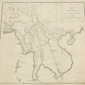
A sketch of the Birman Empire: from a Map of India extra Ganjem
1800
Cambodia, Laos, Myanmar, Thailand, Vietnam
This map from 1800 is by the Scottish cartographer Alexander Dalrymple, who was the first Hydrographer of the British Admiralty. It documents the river systems of the Birman Empire (Myanmar) and modern Thailand, Laos, Cambodia and Vietnam.

Asia and its islands according to D'Anville
1799
Brunei, Cambodia, East Timor, Indonesia, Laos, Malaysia, Myanmar, Papua New Guinea, Philippines, Singapore, Southeast Asia, Thailand, Vietnam
This late 18th century map features a number of labels describing the local populations, including the Kemoys ('Savage People') of the mountains of Cokin China (Vietnam), the Biayos of Borneo, and the 'Wild People' of the mountains of Pegu (Myanmar).

Le Indie Orientali e il loro arcipelago
1799
Vietnam, Myanmar, Malaysia, Philippines, Singapore, Southeast Asia, Thailand, Laos, Indonesia, East Timor, Cambodia, Brunei
A late 18th century map of Asia featuring rivers, mountains, reefs and shoals. Regions are colour-coded, with the borders of the kingdoms of mainland Southeast Asia in green, and the islands of maritime Southeast Asia in yellow and red.

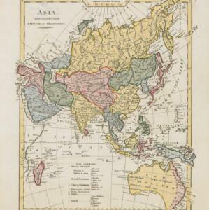
Asia: drawn from the latest astronomical observations
1798
Brunei, Cambodia, East Timor, Indonesia, Laos, Malaysia, Myanmar, Papua New Guinea, Philippines, Singapore, Southeast Asia, Thailand, Vietnam
This late 18th century map of Asia uses colour to differentiate various regions, with mainland Southeast Asia in blue, and maritime Southeast Asia in yellow, red, green and blue.
- Filter from 1478 to 1900
- Indonesia934
- Malaysia563
- Thailand524
- Myanmar523
- Singapore489
- Vietnam479
- Cambodia454
- Laos433
- Brunei427
- Philippines416
- East Timor362
- Southeast Asia355
- more Simple Location »
- Java582
- Sumatra576
- Borneo480
- Malay Peninsula425
- Dutch East Indies379
- Sulawesi370
- Celebes302
- Siam285
- Western New Guinea247
- Maluku Islands239
- Sunda Islands194
- Malacca189
- more Detailed Location »
- Port140
- Pier62
- Railway Station49
- [remove]River1,179
- Road391
- Path205
- Railway/Tramway158
- Canal92
- Postal Route87
- Bridge79
- Telegraph/Telephone50


