Search

Search Results

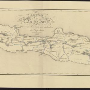
Esquisse de l'ile de Java: divisée en Residences avec indication des chefs-lieux

event1833

location_onIndonesia

Map of Java divided into Dutch administrative areas (‘residencies’), and the Empire of Soerakarta and Kingdom of Djokjakarta, which were under indigenous rule (a note records the territories these indigenous areas lost in the Java War (1825–1830)).

't Groodt Timoor

eventc.1700-1899

location_onEast Timor, Indonesia

Map of Timor with Dutch and Portuguese flags marking military forts. Details are represented pictorially e.g. villages by small houses, forests by trees. There are extensive handwritten annotations, with some text translated from Dutch to French.

close

  • Filter from 1700 to 1833

Current results range from 1700 to 1833