Search

Search Results

Overzichtskaart en bladwijzer van de residentie Madoera

event1883

location_onIndonesia

This overview map of the residency of Madoera (Madura Island, East Java, Indonesia) is divided into four regencies, and subdivided into 21 districts, which are numbered and listed at the bottom of the map. Major roads and settlements are also marked.

[Verzamelkaart van door uitbarsting en vloedgolf verwoeste gebieden]

event1883

location_onIndonesia

Nine maps of the effects of the 1883 Krakatoa volcanic eruption, including on Rakata Island itself, and Calmeyer Island (formed by the eruption). Other maps use brown shading to show the flooding of nearby islands and settlements by ensuing tsunamis.

Kaart van Malang en Omstreken

event1882

location_onIndonesia

Map of the city of Malang, Java, featuring the railway station, military camp, hospital, market etc. The surrounding area has villages, rivers and crops: rice (paddy) fields, coffee, alang-alang, bamboo. Red numbers represent height above sea-level.

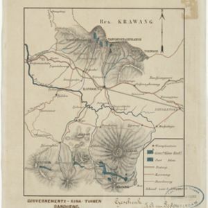
Gouvernements-kina-tuinen, Bandoeng, Java

event1881

location_onIndonesia

This map of Bandung, Java, highlights areas used to cultivate the plant Cinchona (‘Kina’). Its bark produces quinine which was used to treat malaria. A railway line, postal routes, cart roads and bridleways are also shown.

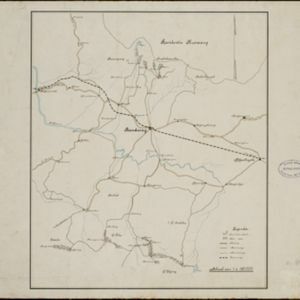
[Kina plantages rond Bandoeng]

event1881

location_onIndonesia

This map of Bandung, Java, highlights areas used to cultivate the plant Cinchona (‘Kina’). Its bark produces quinine which was used to treat malaria. A railway line, postal routes, cart roads and bridleways are also shown.

Topographische kaart de residentie Rembang

event1881

location_onIndonesia

Four-sheet topographic map of the residency of Rembang (Central Java) divided into regencies (pink borders) and districts (yellow borders). Crops—coconut, rice, coffee, bamboo, alang-alang, sugarcane—as well as salt pans and fishing ponds are shown.

Topographische kaart der residentie Kediri

event1879

location_onIndonesia

Four-sheet topographic map of the residency of Kediri (East Java), divided into regencies (pink borders) and districts (yellow borders). Mountains, forests, settlements, routes and crops—sugarcane, alang-alang, rice, coffee, sugar, nutmeg—are shown.

Topographische kaart der residentie Madioen

event1878

location_onIndonesia

Four-sheet topographic map of the mountainous residency of Madioen (Madiun, East Java), divided into regencies (pink borders) and districts (yellow borders). Crops—sugarcane, alang-alang, rice, coffee—sugar factories and coffee warehouses are shown.

Topographische kaart der residentie Krawang

event1877

location_onIndonesia

The residency of Krawang (Karawang), West Java, featuring plantations (coffee, coconut, cinnamon, nutmeg, sugar); crops (rice, alang-alang, bamboo); post offices, routes (road, postal, canals), administrative borders; mountains, rivers, forests.

Topographische kaart der residentie Cheribon

event1877

location_onIndonesia

Six-sheet topographic map of the residency of Cheribon (Cirebon, West Java), with an inset of a geodesic triangle grid. Administrative districts, crops—rice, alang-alang, sugarcane, sugar, coffee, tea—and indigo plant mills are shown.

Java en Madoera

event1875

location_onIndonesia

This detailed late 19th century map shows Java and Madura divided into regencies, and features mountains, roads, railways, and rivers.

close