Search

Search Results

De stad Batavia met derzelver omstreken: Geteekend in 1826

event1898

location_onIndonesia

The city of Batavia (Jakarta) with its port and castle is to the north (right side of the map). Koningsplein (Merdeka Square), a large area of rice paddies, graveyards and villages can be seen to the south (left). Copied from a c.1826 map.

Topographische kaart der residentie Semarang

event1898

location_onIndonesia

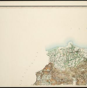
The residency of Semarang, Central Java, featuring crops (coffee, rice, bamboo, nipa palm); cemeteries, post offices, railway stations; routes (railway, postal, road, canal), administrative borders; mountains, rivers, forests.

Map of the Island of Singapore and its dependencies

event1898

location_onSingapore

Map of Singapore Island, divided into Districts, including the surrounding islands and straits. The city centre, roads and forests are marked. MacRitchie Reservoir is at the centre of the island, with coconut plantations along the east coast.

close