Search

Search Results

Algemeene kaart van de ontdekkingen van kapit. J. Cook gedaan op zyne drie togten met de koers van de schepen onder zyn bevel

event1795

location_onBrunei, Cambodia, East Timor, Indonesia, Laos, Malaysia, Myanmar, Papua New Guinea, Philippines, Singapore, Southeast Asia, Thailand, Vietnam

Map charting the three expeditions of the British Royal Navy captain James Cook, including HMS Endeavour’s journey via Batavia (Jakarta) in 1770, and HMS Resolution’s journey through the South China Sea (after Cook’s death) in 1779.

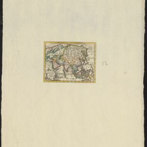
Asia volgens de nieuwste waarnemingen opgesteld

eventc.1790

location_onBrunei, Cambodia, East Timor, Indonesia, Laos, Malaysia, Myanmar, Philippines, Singapore, Southeast Asia, Thailand, Vietnam

A simple hand-coloured map of Asia, with a cartouche of shell, leaves and plants. It shows that in the late 18th century, the details of New Guinea and Australia (‘Nieuw Holland’) were uncertain.

Nieuwe en naukeurige kaart van Asia

event1773

location_onIndonesia, Brunei, Cambodia, East Timor, Laos, Malaysia, Myanmar, Papua New Guinea, Philippines, Singapore, Southeast Asia, Thailand, Vietnam

Map of Asia featuring an early—and very vague—depiction of New Britain (‘Nieuw Brittanje’) which was named by the British explorer William Dampier when he visited in 1700. The ‘Straat van Dampier’ is also shown, dividing New Britain from New Guinea.

Nuove carte delle Isole di Sunda come Borneo, Sumatra e Java Grande &c.

event1740

location_onBrunei, Cambodia, Indonesia, Malaysia, Singapore, Thailand

Based on a Dutch map of the Sunda Islands, with the text changed to Italian. Some Dutch remains e.g. a label on Borneo: ‘Beajous Afgoden dienars bewonende het middelste gedeelte vant Eilland [Beajous idolaters inhabit the middle part of the Island]’.

Nuove carte delle Isole di Sunda come Borneo, Sumatra e Java Grande &c.

eventc.1740-1784

location_onBrunei, Cambodia, Indonesia, Malaysia, Singapore, Thailand

Based on a Dutch map of the Sunda Islands, with the text changed to Italian. Some Dutch remains e.g. a label on Borneo: ‘Beajous Afgoden dienars bewonende het middelste gedeelte vant Eilland [Beajous idolaters inhabit the middle part of the Island]’.

Nieuwe kaart van India over de Ganges: of van Malakka, Siam, Cambodia, Chiampa, Kochinchina, Laos, Pegu, Ava enz.

event1739

location_onBrunei, Cambodia, Indonesia, Laos, Malaysia, Myanmar, Singapore, Thailand, Vietnam, Philippines

On this map, mainland Southeast Asia is divided into regions such as Cochin China, Ciampa and Tunquin (modern Vietnam), Siam (Thailand), Pegu, Aracan and Ava (Myanmar), Malacca (Malaysia), Laos and Cambodia. Rivers and settlements are also shown.

Nieuwe kaart van India: over de Ganges, of van Malakka, Siam, Cambodia, Chiampa, Kochinchina, Laos, Pegu, Ava enz.

event1739

location_onBrunei, Cambodia, Indonesia, Laos, Malaysia, Myanmar, Singapore, Thailand, Vietnam, Philippines

On this map, mainland Southeast Asia is divided into regions such as Cochin China, Ciampa and Tunquin (modern Vietnam), Siam (Thailand), Pegu, Aracan and Ava (Myanmar), Malacca (Malaysia), Laos and Cambodia. Rivers and settlements are also shown.

Nieuwe kaart van de Sundasche eilanden als Borneo, Sumatra en Groot Iava &c.

eventc.1731-1769

location_onBrunei, Cambodia, Indonesia, Malaysia, Singapore, Thailand

On this mid-18th century map of the Sunda Islands, a label on the island of Borneo states ‘Beajous Afgoden dienars bewonende het middelste gedeelte vant Eilland [Beajous idolaters inhabit the middle part of the Island]’.

close