Search

Search Results

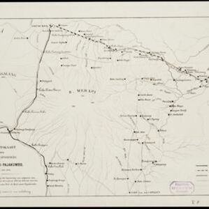
Overzichtskaart van den ontworpen spoorweg Fort de Kock-Pajakombo

event1894

location_onIndonesia

A map of railway lines between Fort de Kock (Bukittinggi) and Pajakombo (Payakumbuh) in western Sumatra. The map includes existing line, planned line and rack railway line (a line with a rack and pinion system so it can operate on steep slopes).

Oostkust Sumatra. Schetskaart der Siak Rivier van het Eiland Tengah tot Siak

event1894

location_onIndonesia

This late 19th century large-scale (1:30,000) map show just a section of the Siak River, in the Riau province of Sumatra. Bathymetry (water depth) is shown in figures to aid navigation, with various landmarks noted along the river’s banks.

Zuidelijk gedeelte van de Chineesche zee: Blad I

event1893

location_onMalaysia, Indonesia, Singapore

Navigation map of the southern part of the South China Sea, including the straits of Malacca and Singapore, and the Riau Archipelago. Bathymetry (sea depth), lighthouses, shoals and other obstructions are marked, with hills to use as landmarks.

Noordwestkust Sumatra: Van Roesa to de Bocht van Pedir

event1893

location_onIndonesia

A navigation map of the northern tip of Sumatra, featuring bathymetry (sea depth), reefs, shoals, and side views of landmark mountains (elevations). Lighthouses are highlighted in red and yellow, with lines to indicate the limits of their range.

Kaart van Nederlandsch-Indie

event1893

location_onBrunei, Cambodia, Indonesia, Malaysia, Singapore, Thailand, Vietnam, East Timor, Philippines, Southeast Asia

Shipping routes are the focus of this map of the Dutch East Indies, indicated by red lines labelled with the name of the shipping company and the destinations. Parcel shipping routes are also shown. Inset maps feature railway lines too.

Sumatra Oostkust: Monden der Koealoe en Panei rivieren

event1892

location_onIndonesia

Navigation map of the mouths of the Koealoe (Kualu) and Panei (Barumun and Bila) rivers on the east coast of Sumatra. Large sand and mud banks, bathymetry (sea depth), bouys and currents are marked. On land, tall trees are shown to use as landmarks.

Kaart van den Indischen-Archipel, Aanwijzende de standplaatsen der Europeesche ambtenaren bij het Binnenlansch Bestuur

event1891

location_onIndonesia

This map of the Dutch East Indies uses colour to demarcate government administrative areas (residencies or provinces), with red dots/flags indicating the locations of various levels of government officials. With inset maps of west Sumatra and Java.

Kaart van de Karo landen (Oost Sumatra)

event1891

location_onIndonesia

A map recording five Dutch expeditions through the Karo Lands of northern Sumatra. The mountainous terrain is represented by contour lines, with peaks’ heights marked. The names of groups of the indigenous Karo people are shown in large letters.

Emplacement Belawan 1888 / Emplacement Belawan 1890: Zuidelijke Uitbreiding

event1891

location_onIndonesia

Two plans of an emplacement (railway yard) at Belawan Port in Medan, North Sumatra, showing it in 1888 and again in 1890 after it had been extended with new railway track, buildings and docks.

Deli: Spoorweg maatschappij

event1891

location_onIndonesia

A map of the railway/tramway system of the Deli district on the northeast Sumatra coast. Existing and projected lines are shown, with stops and stations, as well as ‘draagbaar’ railways (a railway with movable tracks made by the Decauville company).

Kaart van het gebied bezet in Groot-Atjeh

event1891

location_onIndonesia

A map of Groot-Atjceh and the city of Kota Radja (modern Banda Aceh) at the northern tip of Sumatra, detailing routes (rivers, roads, railways), crops (rice, banana, sugarcane, betel, reed, alang-alang, bamboo) and land features (forests, wetlands).

Schetskaart van het terrein doorloopen bij de excursie in 1890 tegen de Battaksche landschappen Loemban-Pinasa en Djandji

event1891

location_onIndonesia

Map of an expedition route—in red—through the country of the Batak people of northern Sumatra, from Lake Toba to Loemban-Pinasa (Lumban Pinasa) and Djandji. Mountains and forests are shown, along with two drawings of views of hills.

close