Search Results

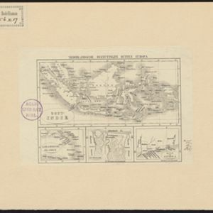
Nederlands Oostindische bezittingen, 1848
1848
Brunei, East Timor, Indonesia, Malaysia, Philippines, Singapore
Map of the Dutch East Indies, with blue borders showing the extent of Dutch colonial territory in 1848. It was published by the North Holland Regional Association of the Dutch Teachers' Association.
- Filter from 1595 to 1900
- Indonesia597
- Malaysia133
- Singapore115
- Brunei106
- Thailand105
- East Timor104
- Philippines89
- Vietnam86
- Cambodia84
- Myanmar67
- Laos65
- Southeast Asia63
- more Simple Location »
- Port112
- Pier59
- Railway Station49
- River471
- Road315
- Path180
- Railway/Tramway111
- Postal Route97
- Canal65
- Bridge62
- Telegraph/Telephone32


