Search Results
6 Results found

China
1898
Brunei, Cambodia, East Timor, Indonesia, Laos, Malaysia, Myanmar, Philippines, Singapore, Southeast Asia, Thailand, Vietnam
This map highlights the colonisation of Southeast Asia, showing French Indochina (green), British Burma and Malaya (orange), the Dutch East Indies (pink), and the Spanish Philippines (green). In the region, only Siam (yellow) is independent.

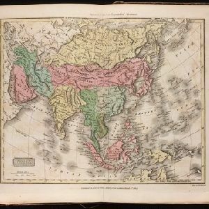
Asia. Engraved for Evans's Geographical Grammar
1809
Brunei, Cambodia, East Timor, Indonesia, Laos, Malaysia, Myanmar, Papua New Guinea, Philippines, Singapore, Southeast Asia, Thailand, Vietnam
This early 19th century map depicts the regions of Asia by colour. The continental regions are green, while the archipelago regions are red, except for New Guinea which is yellow.

A new chart of the Oriental Seas and Islands... from the Isle of Ceylon to Amoye in China
1790
Brunei, Cambodia, East Timor, Indonesia, Laos, Malaysia, Myanmar, Philippines, Singapore, Southeast Asia, Thailand, Vietnam
A late 18th century maritime map of Southeast Asia, marked with expedition routes including the return of Captain Cook’s HMS Endeavour from Australia in 1770, and Captain Philip Carteret’s circumnavigation expedition in 1768.

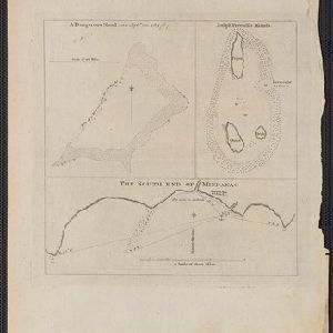
A dangerous shoal seen Septr. the 28, 1767 (Joseph Freewills Islands)
1773
Philippines, Indonesia
These three maps are marked with shoals, rocks, water depth, safe entry points, and anchorage locations, to help ships safely anchor. The sites include the Joseph Freewill Islands (Mapia Atoll, Indonesia) and the coast of Mindanao in the Philippines.


