Search

Search Results

A sketch map of the East Indian possessions of the Netherlands

event1886

location_onBrunei, Indonesia, Malaysia, Papua New Guinea, Philippines, Singapore

Produced by the Intelligence Branch of the British War Office, this map shows Dutch colonial territories in maritime Southeast Asia, and their political and military divisions in Java and Madura. British and Spanish territories are also marked.

Zoological Geography: Sheet No. 1

event1849

location_onBrunei, Cambodia, East Timor, Indonesia, Laos, Malaysia, Myanmar, Papua New Guinea, Philippines, Singapore, Southeast Asia, Thailand, Vietnam

Five maps showing the distribution of animal species, including in Southeast Asia, covering primates, marsupials, pachyderms and Edentata. Lines show the geographical range of individual species, alongside illustrations of the animals featured.

New Holland and Asiatic Isles

event1829

location_onIndonesia, East Timor, Papua New Guinea

Includes part of maritime Southeast Asia. New Guinea is labelled as ‘discovered in 1527’—a reference to the Portuguese explorer Jorge de Menezes—with additional labels describing the terrain (‘Very low land’, ‘Coast is not well known’, ‘An Opening’).

New Holland and Asiatic Isles

event1814

location_onIndonesia, East Timor, Papua New Guinea

Includes part of maritime Southeast Asia. New Guinea is labelled as ‘discovered in 1527’—a reference to the Portuguese explorer Jorge de Menezes—with additional labels describing the terrain (‘Very low land’, ‘Coast is not well known’, ‘An Opening’).

A new chart of the eastern straits to China drawn from the best authorities

event1800

location_onIndonesia

Two maps of routes around the Flores and Banda seas—through the straits between the Lesser Sunda Islands and the Maluku Islands—towards China. Includes a rhumbline network—a web of lines to help plot routes—bathymetry (sea depth), shoals and reefs.

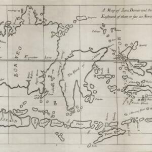
A map of Java, Borneo and the islands to the eastward of them as far as Nova Guinea

event1744

location_onIndonesia, East Timor

A simple mid-18th century map featuring Borneo, Java, Celebes (Sulawasi) and many other smaller islands as far as New Guinea to the east, and Timor to the south. The only details are the names of the islands and some larger settlements.

The Molucca Ilands &c.

eventc.1680-1700

location_onEast Timor, Indonesia, Philippines

From Robert Morden’s ‘Geography Rectified’, a description with maps of the known world in the late 17th century. The map shows the Moluccas, but the text describes the Philippines: Spanish colonial rule, trade, the city of Manila and port of Cavite.

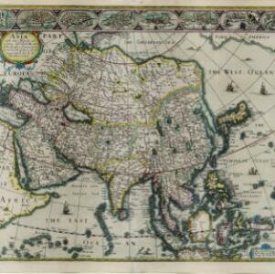
Asia with the islands adioyning described, the atire of the people, & townes of importance

eventc.1646-1657

location_onBrunei, Cambodia, East Timor, Indonesia, Laos, Malaysia, Myanmar, Philippines, Singapore, Southeast Asia, Thailand, Vietnam

This map is illustrated with drawings of Asian people wearing traditional clothing, including representatives of Sumatra, Java and the Maluku Islands. There are also drawings of important ports such as Bantam (Banten) at the western end of Java.

close

  • Filter from 1646 to 1886

Current results range from 1646 to 1886