Search

Search Results

Map of the Malay Peninsula 1879

event1879

location_onMalaysia, Singapore, Thailand

Six-sheet map of the Malay Peninsula, featuring settlements, mountains and rivers. Labels note names of indigenous peoples, or describe terrain/resources. There is an inset map of Singapore town, and the Straits Settlements are highlighted in red.

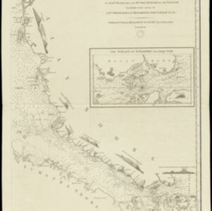
A new chart of the Straits of Malacca

event1830

location_onMalaysia, Indonesia, Singapore

Map of the Strait of Malacca, with inset maps of a central part of the strait and of the Singapore Strait. Bathymetry (sea depth), shoals and reefs are marked, and there are elevations (side views of hills and mountains to use as landmarks).

Map of the island of Sumatra constructed chiefly from surveys taken by order of the late Sir Thos. Stamford Raffles

event1829

location_onIndonesia, Malaysia, Singapore

On this map of Sumatra, the west coast mountain ranges contrast with the rivers to the east. An inset map of Singapore focuses on jungles along the coasts, and features bathymetry (sea depth) around the south coast and along the Singapore Strait.

The coast of India from Pulo Timon to Pulo Cambir comprehending the Malayan coast, the Gulf of Siam, the coasts of Tsiampa and Cochinchina, with the adjacent islands and part of the isle of Borneo

event1794

location_onThailand, Malaysia, Cambodia, Indonesia, Brunei, Vietnam

Nautical charts like this are detailed around the coasts and on the seas (e.g. river mouths, islands, shoals and reefs) while the interiors are blank. The web of lines is a rhumbline network, while the numbers indicate sea depth (bathymetry).

Chart... Shewing the Connection and respective distances by Sea, between the principal harbours and Settlements in the East Indies

event1794

location_onThailand, Myanmar, Malaysia, Indonesia

Maritime routes had to be adjusted in response to the changing monsoon seasons, as is seen on this late 18th century map of the Indian Ocean. Drawings of the heads of children blowing—called ‘wind-heads’—are used to indicate wind direction.

A chart of the seas between the Straits of Banca and Po. Timon: with the eastern part of the Straits of Malacca

event1767

location_onIndonesia, Malaysia

This mid-18th century maritime map charts the seas between Peninsula Malaysia and Sumatra, including Singapore—named ‘Po. Panjang’—with the old and new Straits of Singapore marked. The numbers indicate sea depth (bathymetry).

close

  • Filter from 1767 to 1879

Current results range from 1767 to 1879