Search

Search Results

Carte des Indes Orientalis

event1748

location_onBrunei, Cambodia, East Timor, Indonesia, Laos, Malaysia, Myanmar, Philippines, Singapore, Southeast Asia, Vietnam, Thailand

This mid-18th century map features labels noting the local populations, including the Kemois of the mountains and deserts of Cochinchinae (Vietnam) and the Byayos of Borneo. The map’s cartouche is embellished with maritime and military paraphernalia.

Carte des Indes Orientales: I. feuille

event1748

location_onMyanmar, Cambodia, Indonesia, Laos, Malaysia, Singapore, Thailand, Vietnam

Map featuring the ancient kingdoms of mainland Southeast Asia. The cartouche is embellished with maritime and military paraphernalia. The map is dedicated to William IV, Prince of Orange (Guillaume Charles Henry Friso). Sheet one of two.

Carte des Indes Orientales

event1748

location_onBrunei, Cambodia, East Timor, Indonesia, Laos, Malaysia, Myanmar, Philippines, Singapore, Southeast Asia, Thailand, Vietnam

This mid-18th century map features a label noting that the Byayos people inhabited the mountains of central Borneo. Another note at the northeast tip of Borneo states that the location and number of islands in the area is uncertain.

Hemisphere oriental: dressé en 1720 pour l'usage particulier du Roy sur les observations astronomiques et geographiques

event1724

location_onBrunei, Cambodia, East Timor, Indonesia, Laos, Malaysia, Myanmar, Papua New Guinea, Philippines, Singapore, Southeast Asia, Thailand, Vietnam

This map of the Eastern Hemisphere (Asia, Europe, Africa) shows New Guinea (‘Nouvelle Guinee’) and Australia (‘Nouvelle Hollande’) as one landmass, demonstrating that there was some uncertainty about the area’s geography in the early 18th century.

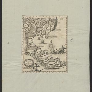
Carte a faite sur les lieux par Daniel Tavernier in plusieurs Voiages qu'il fait au Tonquin

event1679

location_onVietnam

Early map of the coast of Tunquin (modern northern Vietnam) made by the French merchant and adventurer Daniel Tavernier. It features a drawing of Poseidon/Neptune riding in a sea chariot pulled by horses, and extensive notes describing the region.

close