Search

Search Results

Isles de Banda = Eylanden van Banda

eventc.1772-1780

location_onIndonesia

Map of the Banda Islands—which was at this time the only source of nutmeg in the world—featuring mountains, plantations, settlements and a military fort. On the island of Goenong Api (Banda Api) a volcano erupts (‘api’ means ‘fire’ in Indonesian).

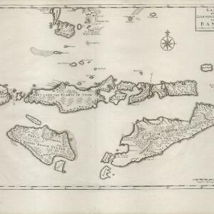
Kaart der Zuyd-Wester Eylanden van Banda

eventc.1724-1726

location_onEast Timor, Indonesia

Although this map’s title refers to the south-western islands of the Banda Islands, it actually focuses on the Lesser Sunda Islands, including Flores, Sumba and Timor. The islands feature mountains and jungle, with shoals and reefs around the coasts.

Insvlarvm Bandanensivm: novißima delineatio

eventc.1680-1709

location_onIndonesia

A navigation map of the Banda Islands marked with bathymetry (sea depth), shoals and anchor points. On the island of Goenonghapy (Banda Api), a volcano erupts (‘api’ means ‘fire’ in Indonesian), and there is a military fort (‘Campa Nga’) on Nera.

close

  • Filter from 1680 to 1772

Current results range from 1680 to 1772