Search

Search Results

Route chart to India and the East

event1895

location_onBrunei, Cambodia, East Timor, Indonesia, Laos, Malaysia, Myanmar, Philippines, Singapore, Southeast Asia, Thailand, Vietnam

Map of Asia featuring steamship routes—including around Southeast Asia—connecting ports such as Penang, Singapore, Batavia (Jakarta), Saigon, Bangkok, Rangun (Yangon), Manila, Macassar (Makassar) etc. There is also an inset map of Singapore.

Kaart van den Nederlandsch-Indischen Archipel

event1890

location_onIndonesia, East Timor, Brunei, Cambodia, Malaysia, Philippines, Singapore, Southeast Asia, Thailand, Vietnam

The seas of the Dutch East Indies are the focus of this map, with maritime routes, sea temperature, sea depth, currents and monsoons shown. There are graphs of population by ethnicity, agriculture and livestock, trade and shipping, and trade exports.

Océan Indien

event1889

location_onBrunei, Cambodia, East Timor, Indonesia, Laos, Malaysia, Myanmar, Philippines, Singapore, Southeast Asia, Thailand, Vietnam

A nautical chart of the Indian Ocean showing bathymetry (sea depth), including in great detail around the seas and straits of Southeast Asia.

Land- en zeekaart der Banda-eilanden

event1871

location_onIndonesia

Two maps of the Banda Islands—one of the whole group; the other focusing on the larger islands only—with an elaborate cartouche illustrated with six views of the islands. There is also a drawing of the volcano on Goenong Api (Banda Api).

Kaart van de voornaamsten der Banda Eilanden

event1854

location_onIndonesia

Map of the Banda Islands, with a volcano on Goenong Api, two forts (‘Ft. Belgica’ and ‘Ft. Nassau’) on Neira, and a list of the heights of the mountains. (From ‘Algemeene Atlas van Nederlandsche Indie [General Atlas of the Dutch East Indies]’.)

A chart of the Indian and Pacific Oceans with particular plans of the harbours

event1847

location_onBrunei, Cambodia, East Timor, Indonesia, Laos, Malaysia, Myanmar, Papua New Guinea, Philippines, Southeast Asia, Singapore, Thailand, Vietnam

Southeast Asia is shown on sheets two and three of this 12-sheet map of the Indian and Pacific oceans, including detailed inset maps of the straits of Singapore, Bangka, Gaspar and Sunda, with bathymetry (sea depth), shoals, reefs, anchorages etc.

A new chart of the eastern straits to China drawn from the best authorities

event1800

location_onIndonesia

Two maps of routes around the Flores and Banda seas—through the straits between the Lesser Sunda Islands and the Maluku Islands—towards China. Includes a rhumbline network—a web of lines to help plot routes—bathymetry (sea depth), shoals and reefs.

A New Chart of the Eastern Straits, or the Straits to the East of Java, with a part of the Banda Sea

event1798

location_onEast Timor, Indonesia

A late 18th century maritime navigation map of the straits east of Java, with drawings of the elevations of the straits. The map is also marked with routes of explorers, including the return of Captain Cook’s HMS Endeavour from Australia in 1770.

[Dutch portolan chart of the eastern Dutch East Indies]

event1700

location_onIndonesia, East Timor

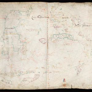
This colourful hand-drawn portolan (nautical) chart was designed to aid navigation. It features a rhumbline network (the web of interconnected lines), bathymetry (sea depth), shoals and reefs, anchor points and written notes.

Insvlarvm Bandanensivm: novißima delineatio

eventc.1680-1709

location_onIndonesia

A navigation map of the Banda Islands marked with bathymetry (sea depth), shoals and anchor points. On the island of Goenonghapy (Banda Api), a volcano erupts (‘api’ means ‘fire’ in Indonesian), and there is a military fort (‘Campa Nga’) on Nera.

close