Search

Search Results

Vaarwaters en ankerplaatsen op de oostkust van Borneo: Blad III

event1899

location_onIndonesia

Navigation maps of two bays on the southeast coast of Borneo. Anchorages, bathymetry (sea depth), buoys, shoals and other obstructions are shown. There is an inset map of the roadstead—a body of water sheltered from tides/currents—at Balikpapan Bay.

Kaart der residentie Zuider- en Ooster-afdeeling van Borneo

event1899

location_onIndonesia

On this map, the residency of South and East Borneo is divided into departments (green borders) and provinces (yellow borders). There is an inset plan of the city of Banjarmasin, with rivers, buildings, residential areas, roads and crops marked.

Kaart de residentie Wester-afdeeling van Borneo

event1898

location_onIndonesia

Topographical map of western Borneo, with inset maps of the islands off the west coast, and of the city of Pontianak including the docks and crops grown near the city (rice, coconut, mangosteen, sago, alang-alang, indigo plant, sugarcane, bamboo).

Atlas van Nederlandsch Oost-Indië

eventc.1897-1904

location_onIndonesia

Very detailed atlas of the entire Dutch East Indies, over 16 map sheets, with a cover and overview map. Includes topographic maps, inset maps of cities and islands, and maps featuring land and sea routes, languages, geology, colonial territory etc.

Vaarwaters en ankerplaatsen op de Oostkust van Borneo: Blad I

event1896

location_onIndonesia

Four navigation maps of waterways on the northeast coast of Borneo, including the Karang Muaras reef. Anchorages, bathymetry (sea depth), shoals and other obstructions are shown, with trees, hills and elevations (side views of hills) as landmarks.

Kaart van den Indischen-Archipel, Aanwijzende de standplaatsen der Europeesche ambtenaren bij het Binnenlansch Bestuur

event1891

location_onIndonesia

This map of the Dutch East Indies uses colour to demarcate government administrative areas (residencies or provinces), with red dots/flags indicating the locations of various levels of government officials. With inset maps of west Sumatra and Java.

Kaart van den Indischen Archipel aangevende den bestaanden toestand met betrekking tot de Gouvernements Monopoliën van Opium en Zout

event1882

location_onIndonesia

Different levels of government monopolies are indicated on this map of the Dutch East Indies by the use of areas of colour (opium trade) and hash marks (salt trade). The inset map of Java is divided into residencies.

Nederlandsch Oost-Indië

event1865

location_onBrunei, Cambodia, East Timor, Indonesia, Laos, Malaysia, Myanmar, Vietnam, Thailand, Southeast Asia, Singapore, Philippines, Papua New Guinea

This detailed map of the Dutch East Indies in the mid-19th century contains a great deal of information: topographical details, settlements and administrative areas, roads, railways and maritime routes, telegraph lines, inset maps etc.

Kaart van de Zuider- en Ooster Afdeeling van Borneo

eventc.1865

location_onIndonesia

Map of the South and East Department of Borneo, focusing on the rivers and settlements along the rivers. The names of local districts are also printed on the map.

School-kaart van Oost-Indië

event1854

location_onIndonesia

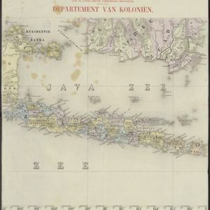
One sheet (of eight) from a map of the Dutch East Indies, used in schools in the mid-19th century. Java is divided into residencies, and mountains—represented by short lines/dashes called hachures—major roads and settlements are shown.

Kaart der verkennings reizen op Borneo

event1853

location_onIndonesia

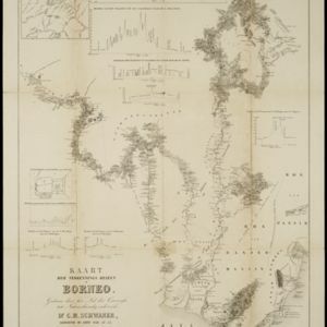
Map charting expeditions in southern and eastern Borneo by the German geologist Carl Schwaner in the 1840s. Includes an inset map of rivers and watersheds in central Borneo, nine cross sections of the heights of rivers, and a plan of a gold mine.

Carte générale des possessions néerlandaises aux Indes orientales

event1846

location_onBrunei, East Timor, Indonesia, Malaysia, Philippines, Singapore

Map of the Asian colonial possessions of the Netherlands (Dutch East Indies), with an inset of the heights of some of the region’s mountains. A note describes the average temperature, barometer reading and magnetic declination in Batavia at the time.

close

  • Filter from 1839 to 1899

Current results range from 1839 to 1899