Search

Search Results

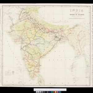
India to illustrate the gauges of railways

event1899

location_onMyanmar

This map of India and Burma (Myanmar) shows railways, and railways sanctioned or under construction. The lines on Myanmar are all metre gauge. There is also a list of the railway lines shown, with their route and length.

India shewing railways

event1898

location_onMyanmar

This map of India and Burma (Myanmar) shows railways, and railways sanctioned or under construction. There is a list of the railway lines shown, with their route and length. Other maps show the same area in different years of the 1890s.

India shewing railways

event1897

location_onMyanmar

This map of India and Burma (Myanmar) shows railways, and railways sanctioned or under construction. Other maps in this series show the same area in different years of the 1890s.

India shewing railways

event1896

location_onMyanmar

This map of India and Burma (Myanmar) shows railways, and railways sanctioned or under construction. Other maps in this series show the same area in different years of the 1890s.

India

event1895

location_onMyanmar

On this map of India, Burma (Myanmar) is divided into administrative regions. Borders with India and Siam are hand-coloured.

India shewing railways

event1895

location_onMyanmar

This map of India and Burma (Myanmar) shows railways, and railways sanctioned or under construction. Other maps in this series show the same area in different years of the 1890s.

Telegraph map of India

event1894

location_onMyanmar

Spread over six sheets, this map of India also features Burma (Myanmar) on sheet four and on an inset map on sheet six. Telegraph lines are shown connecting the telegraph offices in cities and towns, including lines and offices under construction.

India shewing railways

event1894

location_onMyanmar

This map of India and Burma (Myanmar) shows railways, and railways sanctioned or under construction. Other maps in this series show the same area in different years of the 1890s.

India shewing railways

event1893

location_onMyanmar

This map of India and Burma (Myanmar) shows railways, and railways sanctioned or under construction. Other maps in this series show the same area in different years of the 1890s.

India: Sugar cane

event1893

location_onMyanmar

On this map of India and Burma (Myanmar), shading indicates what percentage of each province is used for the cultivating sugarcane. Part of a series of maps of the same area showing different crops (others include cotton and rice).

India: Rice

event1893

location_onMyanmar

On this map of India and Burma (Myanmar), shading indicates what percentage of each province is used for the cultivating rice. Part of a series of maps of the same area showing different crops (others include cotton and sugarcane).

India: Cotton

event1893

location_onMyanmar

On this map of India and Burma (Myanmar), shading indicates what percentage of each province is used for the cultivating cotton. Part of a series of maps of the same area showing different crops (others include rice and sugarcane).

close

  • Filter from 1891 to 1899

Current results range from 1891 to 1899