Search

Search Results

Asia

event1860

location_onPapua New Guinea, Brunei, Cambodia, Indonesia, Laos, Malaysia, Myanmar, Philippines, Singapore, Southeast Asia, Thailand, Vietnam

This mid-19th century map of Asia has colour-coded borders that show the beginnings of the emergence of the modern nation states of Southeast Asia, such as Laos, Burmah (Burma), Siam (Thailand) and Malaya (Malaysia).

Übersichtskarte der Asiatischen Staaten

event1845

location_onBrunei, Cambodia, Indonesia, Laos, Malaysia, Myanmar, Philippines, Singapore, Southeast Asia, Thailand, Vietnam

This map of Asia is from the mid-19th century ‘Grosser Atlas der Erde [Great Atlas of the Earth]’ by the German publisher Albrecht Platt. It shows part of Southeast Asia, including the region’s borders with India and China.

A New general map of the East Indies, exhibiting in the Peninsula on this side of the Ganges or Hindoostan, the several partitions of the Mogul's Empire

event1823

location_onMalaysia, Brunei, Indonesia, Cambodia, Thailand, Vietnam, Myanmar, Laos, Southeast Asia

This 19th century map highlights British colonial possessions in India (in red), and the various kingdoms of northern Southeast Asia, including the Birman Empire (Myanmar), Cochin China and Tonkin (Vietnam), Lao (Laos), Siam (Thailand), and Cambodia.

Asia, according to the best Authorities

event1795

location_onBrunei, Cambodia, East Timor, Indonesia, Laos, Malaysia, Myanmar, Philippines, Singapore, Southeast Asia, Thailand, Vietnam

A late 18th century map of Asia with regions divided by colour-coded borders, and detailing rivers, mountains, reefs and shoals.

Asia, according to the best Authorities

event1800

location_onBrunei, Cambodia, East Timor, Indonesia, Laos, Malaysia, Myanmar, Philippines, Singapore, Southeast Asia, Thailand, Vietnam

A late 18th century map of Asia with regions divided by colour-coded borders, and detailing rivers, mountains, reefs and shoals.

Exactissima Asiae delineatio, in praecipuas regiones, ceterasq partes divisa

event1702

location_onBrunei, Cambodia, East Timor, Indonesia, Laos, Malaysia, Myanmar, Philippines, Singapore, Southeast Asia, Thailand, Vietnam

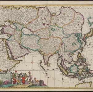
The illustration on this map highlights the wealth of the Asian trade routes, with merchants wearing colourful and elaborate robes presenting valuable treasures to a royal figure. A monkey, tortoise and camel emphasise the 'exoticism' of Asia.

Exactissima Asiae delineatio, in praecipuas regiones, ceterasq partes divisa

event1697

location_onBrunei, Cambodia, East Timor, Indonesia, Laos, Malaysia, Myanmar, Philippines, Singapore, Southeast Asia, Thailand, Vietnam

The cartouche on this late 17th century map of Asia features a colourful illustration of Asian traders negotiating a deal. In the background, their workers carry packages and tend to a camel.

Asia according to ye newest observations

eventc.1670-1732

location_onBrunei, Cambodia, East Timor, Indonesia, Laos, Malaysia, Myanmar, Papua New Guinea, Philippines, Singapore, Southeast Asia, Thailand, Vietnam

A map of Asia by the London-based cartographer Herman Moll (1654?–1732) with colour-coded regional borders. In Southeast Asia, each major land mass or island has its own coloured border.

close

  • Filter from 1670 to 1860

Current results range from 1670 to 1860