Search

Search Results

Carte des Isles de Java, Sumatra, Borneo &a. Les detroits de la Sunde, Malaca, et Banca, Golfe de Siam &a.

eventc.1772-1780

location_onBrunei, Cambodia, Indonesia, Malaysia, Philippines, Singapore, Thailand, Vietnam

This map shows the islands of Java, Sumatra and Borneo, the straits of Sunda, Malacca and Bangka, and the Gulf of Siam. The title is given in both French and Dutch, as are some of the place names on the map.

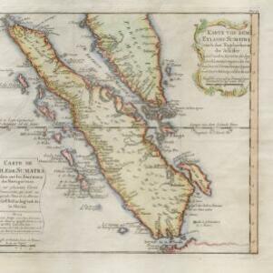
Karte von dem eylande Sumatra nach den tagebüchern der schiffer

event1764

location_onMalaysia, Indonesia, Singapore

The title of this mid-18th century map of Sumatra and the Malay Peninsula claims that it was based on the diaries of sailors. Interestingly, the title is repeated in both German and French, as are the names of some of the locations marked on the map.

Les Isles de la Sonde

event1749

location_onBrunei, Indonesia, Malaysia, Singapore

This colourful mid-18th century map of the Sunda Isles (‘Isles de la Sonde’) includes the Malay Peninsula in addition to Sumatra, Java and Borneo. Mountain ranges and jungles are shown pictorially, and the islands and coasts feature shoals and reefs.

Isles de la Sonde vers l'Occident

event1683

location_onBrunei, Cambodia, Indonesia, Malaysia, Philippines, Singapore, Thailand, Vietnam

This late 17th century map of the western Sunda Islands—Sumatra, Java and Borneo—is decorated with a colourful cartouche probably featuring the Greek god Poseidon and his wife Amphitrite. Cherubs play trumpets and ride on sea monsters.

close

  • Filter from 1683 to 1772

Current results range from 1683 to 1772