Search

Search Results

Map of the Burman Empire including also Siam, Cochin-China, Ton-king and Malaya

event1842

location_onVietnam, Myanmar, Malaysia, Indonesia, Thailand, Laos, Cambodia, Brunei, Singapore

Regional borders are colour-coded on this mid-19th century map of mainland Southeast Asia, with British colonial territory in red (including part of the Burman Empire, the Straits Settlements, and Sarawak on Borneo).

Map of the Burman Empire including also Siam, Cochin-China, Ton-king and Malaya

eventc.1840-1852

location_onVietnam, Malaysia, Myanmar, Cambodia, Thailand, Laos, Singapore, Brunei

Although this mid-19th century map covers all of mainland Southeast Asia, the Burman Empire (Myanmar) is shown in greater detail, especially its districts, rivers and place names. It was produced by the James Wyld, geographer to Queen Victoria.

East India Islands

event1839

location_onVietnam, Myanmar, Papua New Guinea, Philippines, Singapore, Southeast Asia, Thailand, Malaysia, Laos, Indonesia, East Timor, Cambodia, Brunei

The shoals and reefs of maritime Southeast Asia are highlighted on this colourful mid-19th century map, with the treacherous waters around many islands and straits marked.

Chart of the East India Islands: exhibiting the several passages between the Indian and Pacific Oceans

event1824

location_onBrunei, Cambodia, East Timor, Indonesia, Malaysia, Philippines, Singapore, Thailand, Vietnam, Southeast Asia, Myanmar

To aid navigation, this map shows small islands, shoals and reefs, maritime routes for use during monsoons or at particular times of the year, bathymetry (sea depth), past explorers’ routes, shipwrecks and text about monsoons, typhoons and currents.

A new map of the East India Isles

event1801

location_onBrunei, Cambodia, East Timor, Indonesia, Laos, Malaysia, Myanmar, Vietnam, Thailand, Southeast Asia, Singapore, Philippines

An early 19th century map by the English cartographer John Cary, highlighting the mountain ranges and rivers of Southeast Asia. The map also features many place names of cities, towns and islands.

The coast of India from Pulo Timon to Pulo Cambir comprehending the Malayan coast, the Gulf of Siam, the coasts of Tsiampa and Cochinchina, with the adjacent islands and part of the isle of Borneo

event1794

location_onThailand, Malaysia, Cambodia, Indonesia, Brunei, Vietnam

Nautical charts like this are detailed around the coasts and on the seas (e.g. river mouths, islands, shoals and reefs) while the interiors are blank. The web of lines is a rhumbline network, while the numbers indicate sea depth (bathymetry).

A new chart of the Oriental Seas and Islands... from the Isle of Ceylon to Amoye in China

event1790

location_onBrunei, Cambodia, East Timor, Indonesia, Laos, Malaysia, Myanmar, Philippines, Singapore, Southeast Asia, Thailand, Vietnam

A late 18th century maritime map of Southeast Asia, marked with expedition routes including the return of Captain Cook’s HMS Endeavour from Australia in 1770, and Captain Philip Carteret’s circumnavigation expedition in 1768.

The East India Islands: comprehending the Isles of Sunda, the Moluccas and the Philippine Islands

event1789

location_onBrunei, Cambodia, East Timor, Indonesia, Laos, Malaysia, Myanmar, Philippines, Singapore, Southeast Asia, Thailand, Vietnam

Labels on this late 18th century map of Southeast Asia describe two indigenous populations—the ‘Kemoy’ of the mountains along the border of Cochin China (Vietnam) and Camboja (Cambodia), and the ‘Biayos’ of central Borneo—as ‘a wild Nation’.

Present Asia

event1783

location_onVietnam, Myanmar, Philippines, Singapore, Southeast Asia, Thailand, Malaysia, Laos, Indonesia, East Timor, Cambodia, Brunei

Coloured borders divide this late 18th century map of Asia into empires, kingdoms and regions. Five major rivers that flow south through mainland Southeast Asia are named: Aua, Pegu, Tenasserim, Menan and Camboya.

An Accurate Map of the East Indies from the latest Improvements and Regulated by Astronomical Observations

event1777

location_onBrunei, Indonesia, Malaysia, Cambodia, Laos, Myanmar, Singapore, Thailand, Vietnam

The ancient kingdoms of mainland Southeast Asia are shown on this 18th century map, including Ava and Pegu (Myanmar), Siam (Thailand), Tonquin (Vietnam), Laos and—between Cochin China (Vietnam) and Camboja (Cambodia)—‘A Savage Nation called KEMOYS’.

East Indies

event1769

location_onBrunei, Cambodia, East Timor, Indonesia, Laos, Malaysia, Myanmar, Philippines, Singapore, Southeast Asia, Thailand, Vietnam

Longitude is indicated in two different ways on this mid-18th century map: along the top border, it is shown in degrees (number of degrees east of London); more unusually, along the bottom border, it is shown in time (number of hours east of London).

East India islands

event1758

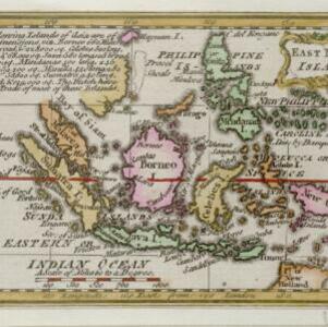
location_onBrunei, East Timor, Indonesia, Malaysia, Philippines, Singapore

Text on this mid-18th century map notes the dimensions of the islands of maritime Southeast Asia, in length, breadth and square miles (e.g. ‘Java 580 long, 105 broad, & 38,250 sq.’). It also states that the Dutch are the main traders in the region.

close