Search

Search Results

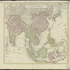
Carte des Indes et de la Chine

event1705

location_onBrunei, Cambodia, East Timor, Indonesia, Laos, Malaysia, Myanmar, Philippines, Southeast Asia, Singapore, Thailand, Vietnam

An early 18th century map of Asia by the French cartographer Guillaume Delisle (1675–1726). Regions are indicated with coloured borders, and the southern part of Borneo is labelled ‘Côte de Mahometans [Coast of the Muslims]’.

Carte des Indes et de la Chine

event1705

location_onBrunei, Cambodia, East Timor, Indonesia, Laos, Malaysia, Myanmar, Philippines, Singapore, Southeast Asia, Thailand, Vietnam

The regional borders of early 18th century Southeast Asia are shown on this map. Mountains are shown pictorially, and larger settlements are marked with a red building symbol. Southern Borneo is labelled ‘Pays des Mahometans [Land of the Muslims]’.

Partie de la nouvelle Grande Cartes des Indes Orientales, contenant les Isles Maldives, Ceylan, Malacca, Sumatra &c.

event1700

location_onIndonesia, Malaysia, Singapore, Thailand

Sumatra and the Malay Peninsula feature on this map of the Indian Ocean. Enganno Island, west of southern Sumatra, has a label that translates as ‘inhabited by very pernicious savages’. An inset map depicts the Madura Strait between Java and Madura.

Carte des Indes et de la Chine

eventc.1700

location_onBrunei, Cambodia, East Timor, Indonesia, Laos, Malaysia, Myanmar, Philippines, Singapore, Southeast Asia, Thailand, Vietnam

The regional borders of early 18th century Southeast Asia are shown on this map. Mountains are shown pictorially, and larger settlements are marked with a building symbol. Southern Borneo is labelled ‘Pays des Mahometans [Land of the Muslims]’.

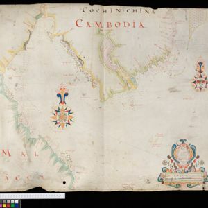
[Portolan chart of the Gulf of Siam]

event1697

location_onThailand, Vietnam, Malaysia, Cambodia

A brightly-coloured hand-drawn map of the Gulf of Siam, made for a ship’s captain. The elaborate compass roses are the centre of a rhumbline network, a web of lines to aid navigation. Bathymetry (sea depth), islands, shoals and reefs are also marked.

[Globe gore covering Asia]

eventc.1693-1707

location_onMalaysia, Cambodia, Indonesia, Laos, Myanmar, Singapore, Thailand, Vietnam

On this map, ‘Lago di Chiamay’, one of number of mythical lakes once thought to exist in southern China, feeds five rivers—labelled ‘Menam’, ‘Pegu’ ‘Maraban’, ‘Cosmin’ and ‘Caor’—which flow south through mainland Southeast Asia.

[Zuid-Chinese Zee]

event1686

location_onIndonesia, Malaysia, Thailand, Cambodia, Vietnam

Early navigation map of the South China Sea. The web of lines is a rhumbline network, while the numbers indicate sea depth (bathymetry), both used to aid navigation. A route around the Gulf of Thailand is marked with text and the dates 1643 and 1644.

close