Search

Search Results

Chart of the China Sea

event1864

location_onPapua New Guinea, Indonesia, Malaysia, Cambodia, East Timor, Philippines, Singapore, Thailand, Vietnam

To aid navigation, this map shows small islands, shoals and reefs, maritime routes for use during monsoons or at particular times of the year, bathymetry (sea depth), tide information, shipwrecks, compass roses and landmark mountains at the coasts.

Hyetographic or rain map of the World

event1849

location_onBrunei, Cambodia, East Timor, Indonesia, Malaysia, Laos, Myanmar, Papua New Guinea, Philippines, Singapore, Southeast Asia, Thailand, Vietnam

A world map, including Southeast Asia, showing rainfall information (darker shading indicates greater rainfall). Southeast Asia lies in the ‘Zone of the Periodical Rains’, and is marked with monsoons and ‘Electrical Explosions’.

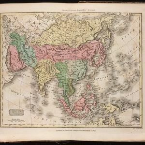
Asia. Engraved for Evans's Geographical Grammar

event1809

location_onBrunei, Cambodia, East Timor, Indonesia, Laos, Malaysia, Myanmar, Papua New Guinea, Philippines, Singapore, Southeast Asia, Thailand, Vietnam

This early 19th century map depicts the regions of Asia by colour. The continental regions are green, while the archipelago regions are red, except for New Guinea which is yellow.

Asie divisée en ses principaux Etats, Empires & Royaumes

event1791

location_onBrunei, Cambodia, East Timor, Indonesia, Laos, Malaysia, Myanmar, Philippines, Singapore, Southeast Asia, Thailand, Vietnam

A late 18th century map of Asia, with notes on the principal states, empires and kingdoms of Asia written in French on the right-hand side.

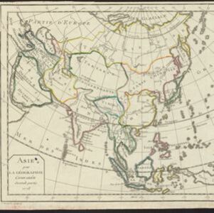
Asie pour La Géographie Comparée: Seconde partie

event1778

location_onBrunei, Cambodia, East Timor, Indonesia, Laos, Malaysia, Myanmar, Papua New Guinea, Philippines, Singapore, Southeast Asia, Thailand, Vietnam

On this map of Asia, New Guinea is shown as two separate islands—the western part as ‘Isle de Papous’ and the eastern part as ‘Nouvelle Guinée’—showing that in the 1770s the details of the region were uncertain.

Nieuwe en naukeurige kaart der Oost-Indische Eilanden

eventc.1770

location_onBrunei, Cambodia, East Timor, Indonesia, Laos, Malaysia, Myanmar, Philippines, Singapore, Southeast Asia, Thailand, Vietnam

Some regions on this map of Southeast have a descriptive label: Sumatra is described as having mines of gold, silver, iron, and sulphur; and elephants, tigers, rhinoceroses, dragons and crocodiles. Gilolo has rice, sago and turtles. Ambon has nutmeg.

Archipel des Indes Orientales: qui comprend les Isles de la Sonde, Moluques et Philippines

eventc.1757-1786

location_onBrunei, Cambodia, East Timor, Indonesia, Malaysia, Philippines, Singapore, Thailand, Vietnam, Southeast Asia

This 18th century map of Southeast Asia by the French cartographer Gilles Robert de Vaugondy features the national borders of the Philippines in green, and of modern Indonesia in yellow. The Malay Peninsula and modern Cambodia and Vietnam are in red.

Archipel des Indes Orientales: qui comprend les Isles de la Sonde, Moluques et Philippines

event1750

location_onBrunei, Cambodia, East Timor, Indonesia, Malaysia, Philippines, Singapore, Southeast Asia, Thailand, Vietnam

This 18th century map of Southeast Asia by the French cartographer Gilles Robert de Vaugondy features the national borders of the Philippines in green, and of modern Indonesia in yellow. The Malay Peninsula and modern Cambodia and Vietnam are in red.

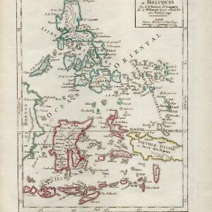
Isles Philippines et Moluques

event1749

location_onIndonesia, Philippines, Papua New Guinea, East Timor

From the second edition (1749) of ‘Atlas Portatif Universel et Militaire’ by the French cartographer Gilles Robert de Vaugondy (1688–1766), this map features the Philippines (in blue) and Maluku Islands (in red).

close