search
search for
search for
search icon
Explore
MapJourneys
Collections
Events
About
Core Team
Search
Search Results
Filter
Detailed Location
Hong River
close
Remove constraint Detailed Location: Hong River
Settlement Features
Kampong/Village
close
Remove constraint Settlement Features: Kampong/Village
View
Gallery
List
Gallery
Map
Sort
Relevance
Relevance
Date (earliest first)
Date (earliest last)
4 Results found
Filter
filter_list
Sketch map to illustrate the Lang-son and Red River operations
event
1886
location_on
Vietnam
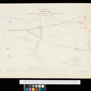
Sketch of works before Phu-sa, showing position of troops at 3 p.m. on the 14th Dec 1883, before the assault
event
1883
location_on
Vietnam
Carte du Cours de la Riviere de Tunquin: depuis Cacho jusqu'à La Mer
event
1755
location_on
Vietnam
Carte du Cours de la Riviere de Tunquin: depuis Cacho jusqu'à La Mer
event
1755
location_on
Vietnam
close
Refine your results
Collections
check_box_outline_blank
Bodleian Libraries, University of Oxford
2
check_box_outline_blank
Leiden University Libraries
2
Date
Filter from
1755
to
1886
Current results range from
1755
to
1886
Date range begin
Date range end
Language
check_box_outline_blank
Dutch
2
check_box_outline_blank
English
2
check_box_outline_blank
French
2
Location
Simple Location
check_box_outline_blank
Vietnam
4
Detailed Location
check_box
[remove]
Hong River
4
check_box_outline_blank
Red River
4
check_box_outline_blank
Hanoi
3
check_box_outline_blank
Baye de Tunquin
2
check_box_outline_blank
Cacho
2
check_box_outline_blank
Gulf of Tonkin
2
check_box_outline_blank
Hean
2
check_box_outline_blank
Rivier van Tonkin
2
check_box_outline_blank
Riviere de Tunquin
2
check_box_outline_blank
Lang-son
1
check_box_outline_blank
Lạng Sơn
1
check_box_outline_blank
Phu-Sa
1
more
Detailed Location
»
Land Use
Settlement Features
check_box
[remove]
Kampong/Village
4
Commerce
check_box_outline_blank
Market
2
Land and Sea Routes
Land Routes
check_box_outline_blank
River
4
check_box_outline_blank
Road
2
Sea Routes
check_box_outline_blank
Bathymetry
2
check_box_outline_blank
Maritime Route
2
Cultural and Political Regions
Political Regions
check_box_outline_blank
Colonial Possessions
1
Environmental Features
Sea Features
check_box_outline_blank
Reef
2
check_box_outline_blank
Shoal
2
Insets and Attributes
Insets
check_box_outline_blank
Cartouche
2
check_box_outline_blank
Legend
2
Map Attributes
check_box_outline_blank
Scale
4
check_box_outline_blank
Compass Rose
2
check_box_outline_blank
Longitude and Latitude
1
Map Production Details
Map Maker
check_box_outline_blank
Bellin, Jacques Nicolas
2
check_box_outline_blank
Schley, Jacobus van der
2
check_box_outline_blank
Webb, F.N.
1
Printer/Publisher
check_box_outline_blank
Intelligence Branch, War Office
2
check_box_outline_blank
Pierre de Hondt
2
Place of Publication
check_box_outline_blank
The Hague
2