Search

Search Results

The Eastern Hemisphere

event1801

location_onMyanmar, Brunei, Cambodia, East Timor, Indonesia, Laos, Malaysia, Vietnam, Thailand, Southeast Asia, Singapore, Philippines

Published by the English cartographer John Cary (c.1754–1835), this map is marked with the routes taken from Europe to Asia by the British Royal Navy captains James Cook, John Gore, and George Vancouver, as well as the French explorer Lapérouse.

Carte hydro-geo-graphique des Indes orientales, en deca̧ et au dela du Gange avec leur archipel

event1771

location_onBrunei, Cambodia, East Timor, Indonesia, Laos, Malaysia, Myanmar, Philippines, Singapore, Southeast Asia, Thailand, Vietnam

The arrows on this map show the direction of the seasonal monsoons of Southeast Asia during the late 18th century. Each arrow has a label in French, indicating the month. The hatched sea areas are where the winds always blow in the same direction.

Isles de la Sonde

event1767

location_onBrunei, Indonesia, Malaysia, Singapore

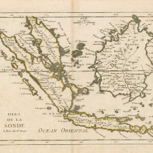
Three of the larger Sunda Islands—Sumatra, Java and Borneo—are shown on this mid-18th century map, along with a few of the smaller islands such as Bali, Lombok and Sumbawa. Celebes (Sulawesi) and some of the other smaller islands are not included.

Isles de la Sonde

event1748

location_onBrunei, Indonesia, Malaysia, Singapore

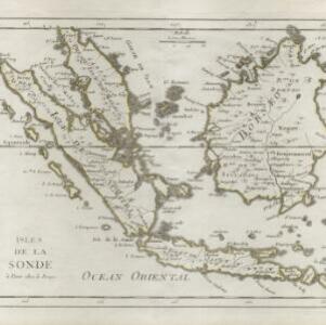
Three of the larger Sunda Islands—Sumatra, Java and Borneo—are shown on this mid-18th century map, along with a few of the smaller islands such as Bali, Lombok and Sumbawa. Celebes (Sulawesi) and some of the other smaller islands are not included.

Insulae Iavae pars Occidentalis

event1728

location_onIndonesia

A map of Java with mountains, jungles, animals and crops. Bathymetry (sea depth) is marked, including on an inset map of Batavia harbour. Illustrations include Batavia Castle, and a lion—representing Belgium—receiving tribute and enslaving locals.

Exactissima Asiae delineatio, in praecipuas regiones, ceterasq partes divisa

event1705

location_onBrunei, Cambodia, East Timor, Indonesia, Laos, Myanmar, Malaysia, Philippines, Singapore, Southeast Asia, Thailand, Vietnam

The illustration on this map highlights the wealth of the Asian trade routes, with merchants wearing colourful and elaborate robes presenting valuable treasures to a royal figure. A monkey, tortoise and camel emphasise the 'exoticism' of Asia.

Nova tabvla India Orientalis

eventc.1702-1705

location_onBrunei, Cambodia, East Timor, Indonesia, Laos, Malaysia, Myanmar, Philippines, Singapore, Southeast Asia, Thailand, Vietnam

An early 18th century map of the Indian Ocean, illustrated with a drawing of Asian merchants riding an elephant and using a camel to transport their goods. Other men use bows and arrows to hunt ostriches. Ships are also shown sailing on the ocean.

Indiae orientalis, nec non insularum adiacentium

event1698

location_onMyanmar, Philippines, Singapore, Southeast Asia, Thailand, Vietnam, Malaysia, Laos, Indonesia, East Timor, Cambodia, Brunei

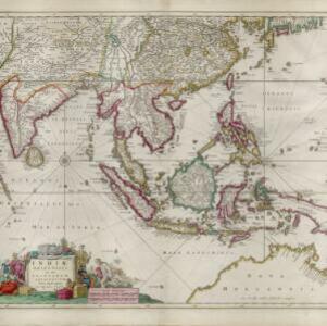
The cartouche on this map of Asia is decorated with a colourful painting illustrating the region’s commerce, with Asian merchants displaying an assortment of goods, including jewellery, porcelain vessels and figurines, textiles and exotic animals.

Isole dell'Indie divise in Filippine, Molucche e della Sonda

eventc.1691-1696

location_onBrunei, Cambodia, East Timor, Indonesia, Laos, Malaysia, Myanmar, Philippines, Singapore, Southeast Asia, Thailand, Vietnam

Dotted lines and colours divide maritime Southeast Asia into three regions on this map: the Philippine archipelago, Maluku Islands and Sunda Islands. The cartouche features cherub mermaids carrying a banner and shield.

Isole dell'Indie divise in Filippine, Molucche e della Sonda

event1680

location_onBrunei, Cambodia, East Timor, Indonesia, Malaysia, Laos, Myanmar, Philippines, Singapore, Southeast Asia, Thailand, Vietnam

Dotted lines and colours divide maritime Southeast Asia into three regions on this map: the Philippine archipelago, Maluku Islands and Sunda Islands. The cartouche features cherub mermaids, and a map of mainland Southeast Asia is on the reverse.

Carta particolare del stretto di Sunda fra l'Isole di Sumatra é Iaua maggre

event1661

location_onIndonesia

This mid-17th century Italian map is from Sir Robert Dudley's atlas ‘Dell'arcano del Mare’. It shows the Sunda Strait (‘Stretto di Sunda’) between the Southeast Asian islands of Sumatra and Java. Text on the map refers to currents (‘Corrente’).

Mar di India

event1659

location_onBrunei, Cambodia, East Timor, Indonesia, Laos, Malaysia, Myanmar, Philippines, Singapore, Southeast Asia, Thailand, Vietnam

This mid-17th century map of the Indian Ocean has a colourful cartouche illustrated with paintings of Asian merchants and warriors with bows and arrows. The scale is decorated with paintings of cherubs.

close

  • Filter from 1619 to 1801

Current results range from 1619 to 1801