Search

Search Results

Kaart van Nederlandsch-Indie

event1893

location_onBrunei, Cambodia, Indonesia, Malaysia, Singapore, Thailand, Vietnam, East Timor, Philippines, Southeast Asia

Shipping routes are the focus of this map of the Dutch East Indies, indicated by red lines labelled with the name of the shipping company and the destinations. Parcel shipping routes are also shown. Inset maps feature railway lines too.

Kaart van den Nederlandsch-Indischen Archipel

event1890

location_onIndonesia, East Timor, Brunei, Cambodia, Malaysia, Philippines, Singapore, Southeast Asia, Thailand, Vietnam

The seas of the Dutch East Indies are the focus of this map, with maritime routes, sea temperature, sea depth, currents and monsoons shown. There are graphs of population by ethnicity, agriculture and livestock, trade and shipping, and trade exports.

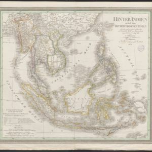
Hinter Indien nebst den Hinterindischen Inseln

event1836

location_onCambodia, East Timor, Indonesia, Laos, Malaysia, Myanmar, Brunei, Philippines, Singapore, Southeast Asia, Thailand, Vietnam

Coloured borders identify the colonial possessions of Britain, the Netherlands, Spain, Denmark and Portugal in mid-19th century Southeast Asia. Cities are marked with symbols indicating population, and military forts are marked with star symbols.

Hinter Indien nebst den Hinterindischen Inseln

event1836

location_onBrunei, Cambodia, East Timor, Indonesia, Laos, Malaysia, Myanmar, Philippines, Singapore, Southeast Asia, Thailand, Vietnam

Coloured borders identify the colonial possessions of Britain, the Netherlands, Spain, Denmark and Portugal in mid-19th century Southeast Asia. Cities are marked with symbols indicating population, and military forts are marked with star symbols.

Carte de l'Archipel des Indes Orientales, représentant les différens passages entre l'Ocean Indien et le Grand Océan

eventc.1804

location_onBrunei, Cambodia, East Timor, Indonesia, Laos, Malaysia, Myanmar, Philippines, Singapore, Southeast Asia, Thailand, Vietnam

Map focusing on the passages between the islands of maritime Southeast Asia used to travel between the Indian and Pacific oceans. Includes the Strait of Malacca, many straits between the Sunda Islands, and a route through the Maluku Islands.

Chart of East Indian Islands exhibiting the several Passages between the Indian and Pacific Oceans

event1800

location_onBrunei, Cambodia, East Timor, Indonesia, Laos, Malaysia, Myanmar, Philippines, Singapore, Southeast Asia, Thailand, Vietnam

Map focusing on the passages between the islands of maritime Southeast Asia. Many 18th century routes are labelled with the ship/captain’s name and date, and there are notes on some shoals and reefs recording names, details and incidents/shipwrecks.

Tabula Indiæ Orientalis et regnorum adjacentium

event1724

location_onBrunei, Cambodia, East Timor, Indonesia, Laos, Malaysia, Myanmar, Philippines, Singapore, Southeast Asia, Thailand, Vietnam

Colourful map of the East Indies focusing on maritime navigation: there is a compass rose at the centre of a rhumbline network (a web of lines to help plot routes). Shoals, reefs and islands are also marked.

Asia

event1690

location_onBrunei, Cambodia, East Timor, Indonesia, Laos, Malaysia, Myanmar, Papua New Guinea, Philippines, Singapore, Southeast Asia, Thailand, Vietnam

Three sheets of a late 17th century map of Asia, with Southeast Asia on the third sheet. The oceans are decorated with drawings of sailing ships, and there is a detailed scene of Asian merchants, including a chained and kneeling slave and a camel.

close

  • Filter from 1690 to 1893

Current results range from 1690 to 1893