Search Results

Topographische kaart der residentie Soerabaja
1884
Indonesia
The residency of Soerabaja, East Java, featuring crops (coffee, coconut, sugarcane, rice, alang-alang, bamboo) and fishing ponds. Three inset maps: a triangulation map; a map of distances between settlements by types of transport; Bawean Island.

Kaart aangevende 1°. de verdeeling van Java en Madura in gewesten en wat de gouvernements-residentiën betreft, ook in afdeelingen en districten
1884
Indonesia
This late 19th century map shows Java and Madura divided into regencies and departments, and further divided into districts. Government land used for growing coffee, businesses, agriculture, railways, postal routes and major roads are also shown.

Ontwerp drinkwaterleiding voor de stad Cheribon
1884
Indonesia
Hand-drawn map of the design of a drinking water pipeline for the city of Cheribon (Cirebon) on the northern coast of Java. Roads, rivers, rice paddies and other fields are shown. The written notes include the city’s population figures by ethnicity.

Overzichtskaart en bladwijzer der afdeeling Banjoewangi
1883
Indonesia
This overview map of Banjoewangi (Banyuwangi Regency, East Java) features mountains, rivers and the Bali Strait. Distances between settlements are marked along the roads, and there is a small inset map of the city of Banjoewangi.

Topographische kaart der residentie Batavia
c.1882-1883
Indonesia
The residency of Batavia, West Java, featuring plantations (coffee, tea, coconut, cinnamon, nutmeg, sugar); crops (rice, alang-alang, bamboo); fishing ponds; factories, warehouses, shops; routes, administrative borders; mountains, rivers, lakes.

Kaart van het westelijk gedeelte van den Indischen Archipel
1883
Indonesia, Malaysia, Singapore
The shaded area on this map is where volcanic ash fell from the 1883 eruption of Krakatoa (Sunda Strait between Sumatra and Java). Red figures record the thickness of the ash in millimetres; black figures are distance from the eruption in kilometres.

Kaart aangevende den bestaande toestand met betrekking tot het rechtswezen in Ned. Indië
1883
Indonesia
This map highlights the judicial system in the Dutch East Indies (‘Nederlands-Indië’) in the late 19th century. Different colours indicate the areas of authority of the different courts of law. There is an inset map of Java.

Overzichtskaart en bladwijzer van de residentie Madoera
1883
Indonesia
This overview map of the residency of Madoera (Madura Island, East Java, Indonesia) is divided into four regencies, and subdivided into 21 districts, which are numbered and listed at the bottom of the map. Major roads and settlements are also marked.

Handelskaartje van den Nederlandsch Indischen archipel
1883
Indonesia, East Timor
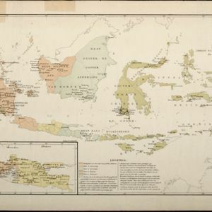
This map is concerned with trade in the Dutch East Indies, highlighting useful resources such as maritime routes, railways, telegraph lines and offices, coast and harbour lights, offices of officials, areas that apply tolls and duties etc.

Wereldkaart volgens Mercator's projectie
1883
Brunei, Cambodia, East Timor, Indonesia, Laos, Malaysia, Myanmar, Papua New Guinea, Philippines, Singapore, Southeast Asia, Thailand, Vietnam
A map charting the effects of the 1883 Krakatoa volcanic eruption: a red circle where the eruption was heard; black lines showing the hourly spread of the resulting waves; and a list of ships on which ash fell, or that encountered pumice (with date).
- Indonesia463
- Malaysia288
- Singapore283
- Brunei277
- East Timor265
- Philippines253
- Thailand240
- Cambodia236
- Vietnam235
- Southeast Asia225
- Laos222
- Myanmar222
- more Simple Location »
- [remove]Java463
- Sumatra311
- Borneo298
- Sulawesi256
- Malay Peninsula249
- Celebes214
- Western New Guinea186
- Maluku Islands183
- Dutch East Indies174
- Siam133
- Sunda Islands133
- South China Sea112
- more Detailed Location »


