Search Results

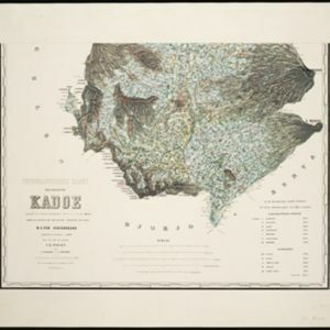
Topographische kaart der residentie Kadoe
1870
Indonesia
The residency of Kadoe (Kadu), Central Java, is shown divided into regencies and districts, with population figures for each district. Villages (kampongs) and towns, fields, mountains, rivers and roads are marked. There is an inset triangulation map.

Kaart van den spoorweg van Samarang naar de Vorstenlanden
1869
Indonesia
This map follows a railway line south from the city of Samarang to Soerakarta and Djokdjokarta (cities in two of the ‘Vorstenlanden’ or ‘Princely Lands’). Other railways, rivers, crops (indigo plants, tobacco, coffee) and sugar factories are marked.


