
Search Results

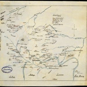
Schetskaart van het boven stroom gebied der Asahan rivier, aek Asahan en aek Bila
1890
Indonesia
Hand-drawn map of the upper basin of the Asahan River, just southeast of Lake Toba in northern Sumatra. Rivers such as the Hoewaloe and Bila are marked in blue, with roads in red, mountains shaded brown, and settlements named.
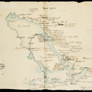

[Omgeving van het Toba meer, afdeelingen Bataklanden, onderafdeelingen Samosir, Toba en Hoogvlakte van Toba]
1890
Indonesia
Hand-drawn map of the southern part of Lake Toba in Sumatra, with roads, rivers and paths marked. Mountains, forest and rice fields are also shown, as are missionary buildings for indigenous and European people.


