Search

Search Results

A map of Java, Borneo and the islands to the eastward of them as far as Nova Guinea

event1744

location_onIndonesia, East Timor

A simple mid-18th century map featuring Borneo, Java, Celebes (Sulawasi) and many other smaller islands as far as New Guinea to the east, and Timor to the south. The only details are the names of the islands and some larger settlements.

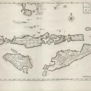
Kaart der Zuyd-Wester Eylanden van Banda

eventc.1724-1726

location_onEast Timor, Indonesia

Although this map’s title refers to the south-western islands of the Banda Islands, it actually focuses on the Lesser Sunda Islands, including Flores, Sumba and Timor. The islands feature mountains and jungle, with shoals and reefs around the coasts.

Solor

eventc.1631-1657

location_onIndonesia

From Ludwig Johann Gottfried’s ‘Newe welt und Americanishe historien’, a drawing of warships—probably Dutch and Portuguese—fighting in the harbour of the volcanic island of Solor (Lesser Sunda Islands). German text describes the region.

close

  • Filter from 1631 to 1744

Current results range from 1631 to 1744