Search

Search Results

East India Islands

event1839

location_onVietnam, Myanmar, Papua New Guinea, Philippines, Singapore, Southeast Asia, Thailand, Malaysia, Laos, Indonesia, East Timor, Cambodia, Brunei

The shoals and reefs of maritime Southeast Asia are highlighted on this colourful mid-19th century map, with the treacherous waters around many islands and straits marked.

Algemeene kaart van de ontdekkingen van kapit. J. Cook gedaan op zyne drie togten met de koers van de schepen onder zyn bevel

event1795

location_onBrunei, Cambodia, East Timor, Indonesia, Laos, Malaysia, Myanmar, Papua New Guinea, Philippines, Singapore, Southeast Asia, Thailand, Vietnam

Map charting the three expeditions of the British Royal Navy captain James Cook, including HMS Endeavour’s journey via Batavia (Jakarta) in 1770, and HMS Resolution’s journey through the South China Sea (after Cook’s death) in 1779.

Bowles's new one-sheet map of Asia, divided into its empires, kingdoms, states, and other subdivisions

event1795

location_onBrunei, Cambodia, East Timor, Indonesia, Laos, Malaysia, Myanmar, Papua New Guinea, Philippines, Singapore, Southeast Asia, Thailand, Vietnam

A late 18th century map of Asia published in London by John Bowles, with regions indicated by colour. Central Borneo is labelled ‘Part inhabited by the Biayos’, which is seen on many contemporary maps, often with the comment ‘a savage people’.

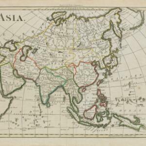
Asia / engraved for Walkers Geography &c.

event1792

location_onBrunei, Cambodia, East Timor, Indonesia, Laos, Malaysia, Myanmar, Papua New Guinea, Philippines, Singapore, Southeast Asia, Thailand, Vietnam

Hand-drawn coloured borders have been added to this map to distinguish various regions: mainland Southeast Asia and most of the islands of maritime Southeast Asia are bordered in green, with Borneo and the Philippines in red.

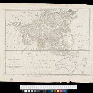
A New & Accurate Map of Asia

event1777

location_onBrunei, Cambodia, East Timor, Indonesia, Laos, Malaysia, Myanmar, Papua New Guinea, Philippines, Singapore, Southeast Asia, Thailand, Vietnam

Created for Middleton’s ‘Complete System of Geography’, this map of Asia includes the ancient kingdoms of mainland Southeast Asia, the Sunda Islands and Moluccas of maritime Southeast Asia, as well as the Philippines and New Guinea.

Nieuwe en naukeurige kaart van Asia

event1773

location_onIndonesia, Brunei, Cambodia, East Timor, Laos, Malaysia, Myanmar, Papua New Guinea, Philippines, Singapore, Southeast Asia, Thailand, Vietnam

Map of Asia featuring an early—and very vague—depiction of New Britain (‘Nieuw Brittanje’) which was named by the British explorer William Dampier when he visited in 1700. The ‘Straat van Dampier’ is also shown, dividing New Britain from New Guinea.

Deese wassende pas-kaart van Oost-Indien, is nu te bekoomen voor die deselve begeeren

eventc.1728-1738

location_onBrunei, Cambodia, East Timor, Indonesia, Laos, Malaysia, Myanmar, Papua New Guinea, Philippines, Singapore, Southeast Asia, Thailand, Vietnam

Map of the Indian Ocean dominated by a rhumbline network—a web of interconnected lines used to help plot routes—with a compass rose at the centre. At the top there are (incomplete) drawings of people with text in Dutch, French, English and Spanish.

L'Asie divisée en ses principales regions, et ou se peuvent voir l'estendue des Empires, Monarchies, Royaumes, et Estats qui partagent présentement l'Asie

event1720

location_onBrunei, Cambodia, East Timor, Indonesia, Laos, Myanmar, Malaysia, Papua New Guinea, Philippines, Singapore, Southeast Asia, Vietnam, Thailand

This map shows the empires, kingdoms and states of Southeast Asia. Its decorative cartouche features drawings of two women—one with a cornucopia and one with a censer (incense burner)—elephant heads, and a French coat of arms. Nine scales are shown.

L'Asie divisée en ses principales regions, et ou se peuvent voir l'estendue des Empires, Monarchies, Royaumes, et Estats qui partagent présentement l'Asie

event1720

location_onBrunei, Cambodia, East Timor, Indonesia, Laos, Malaysia, Myanmar, Papua New Guinea, Philippines, Singapore, Southeast Asia, Thailand, Vietnam

This map shows the empires, kingdoms and states of Southeast Asia. Its decorative cartouche features drawings of two women—one with a cornucopia and one with a censer (incense burner)—elephant heads, and a French coat of arms. Nine scales are shown.

To the Right Honourable William, Lord Cowper, Lord High Chancellor of Great Britain, this map of Asia

event1720

location_onBrunei, Cambodia, East Timor, Indonesia, Laos, Malaysia, Myanmar, Papua New Guinea, Philippines, Singapore, Southeast Asia, Thailand, Vietnam

Map dedicated to William Cowper, whose coat of arms sits atop the cartouche. It features two horses holding a crest with three martlets (mythical birds used in heraldry). The cartouche also features Asian traders. Monsoons are marked on the map.

To the Right Honourable William, Lord Cowper, Lord High Chancellor of Great Britain, this map of Asia

eventc.1715

location_onVietnam, Myanmar, Papua New Guinea, Philippines, Singapore, Southeast Asia, Thailand, Malaysia, Laos, Indonesia, East Timor, Cambodia, Brunei

The arrows on this map show the direction of the seasonal monsoons: each arrow has a label, indicating the month. The northeast coast of Borneo is labelled ‘A Desart [desert/deserted?] Coast’, while the south is labelled ‘Pepper Country’.

close