Search

Search Results

Map of the countries between Bengal and China

event1834

location_onIndonesia, Malaysia, Thailand, Vietnam, Cambodia, Laos, Myanmar, Singapore

The location, size, and population (by ethnicity) of Pinang, Malacca and Singapore—the Straits Settlements—are listed, along with how/when they were acquired by Britain. The distances from Canton (China) to those cities, and to India, are also noted.

Asia

event1814

location_onBrunei, Cambodia, Indonesia, Laos, Malaysia, Myanmar, Philippines, Singapore, Southeast Asia, Thailand, Vietnam

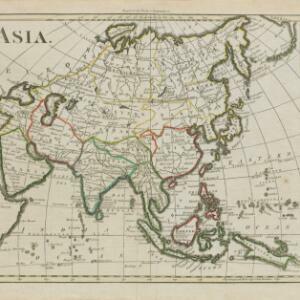
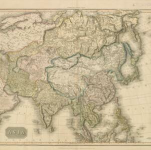
An early 19th century map, with the regions of Southeast Asia marked with coloured borders: Malaya is red, indicating it is part of the British Empire; the orange borders around Sumatra, Borneo and Celebes show they are part of the Dutch East Indies.

Asia / engraved for Walkers Geography &c.

event1792

location_onBrunei, Cambodia, East Timor, Indonesia, Laos, Malaysia, Myanmar, Papua New Guinea, Philippines, Singapore, Southeast Asia, Thailand, Vietnam

Hand-drawn coloured borders have been added to this map to distinguish various regions: mainland Southeast Asia and most of the islands of maritime Southeast Asia are bordered in green, with Borneo and the Philippines in red.

Present Asia

event1783

location_onVietnam, Myanmar, Philippines, Singapore, Southeast Asia, Thailand, Malaysia, Laos, Indonesia, East Timor, Cambodia, Brunei

Coloured borders divide this late 18th century map of Asia into empires, kingdoms and regions. Five major rivers that flow south through mainland Southeast Asia are named: Aua, Pegu, Tenasserim, Menan and Camboya.

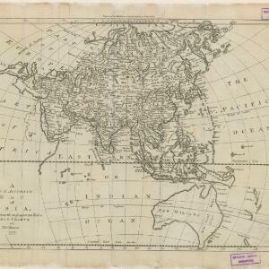
A new & accurate map of Asia: drawn from the most approved modern maps & charts

event1777

location_onBrunei, Cambodia, East Timor, Indonesia, Laos, Malaysia, Myanmar, Papua New Guinea, Philippines, Singapore, Southeast Asia, Thailand, Vietnam

This 18th century map by Thomas Bowen shows some of the ancient kingdoms and islands of Southeast Asia, along with the rest of the Asian continent.

The Sunda Islands vitz Borneo, Sumatra and Java &c. agreable to Modern History

event1770

location_onMalaysia, Indonesia, Singapore

This map of the Sunda Islands features three different locations for the city of Palembang. ‘Palambam’ is in the correct location on Sumatra, while ‘Palimbam’ is in west Java, and ‘Palambang’ is in east Java, a confusion often seen at this time.

Carte des Indes Orientales

event1748

location_onBrunei, Cambodia, East Timor, Indonesia, Laos, Malaysia, Myanmar, Philippines, Singapore, Southeast Asia, Thailand, Vietnam

This mid-18th century map features a label noting that the Byayos people inhabited the mountains of central Borneo. Another note at the northeast tip of Borneo states that the location and number of islands in the area is uncertain.

Nuova carta dell' India di là del Fiume Ganges overo di Malacca, Siam, Cambodia, Chiampa, Kochinchina, Laos, Pegu, Ava &c.

event1740

location_onBrunei, Cambodia, Indonesia, Laos, Malaysia, Myanmar, Singapore, Thailand, Vietnam, Southeast Asia

Based on a map by Guillaume Delisle, this map of Southeast Asia shows mountains and settlements pictorially, with larger cities also coloured red. Regional borders are colour-coded, as are some internal borders on the Malay Peninsula.

The principal islands of the East-Indies: explaining what belongs to England, Spain and Holland &c.

event1732

location_onBrunei, Cambodia, East Timor, Indonesia, Philippines, Malaysia, Thailand, Vietnam, Singapore, Southeast Asia

The letters ‘E’ or ‘D’ are marked after place names to indicate if they are English or Dutch colonial possessions: e.g. ‘Marleborough Fort E’ on Sumatra or ‘Concordia Fort D’ on Timor. The Philippines are labelled ‘to Spain’.

L'Asie dressée sur les observations de Mrs. de l'Academie Royale de Sciences

event1730

location_onBrunei, Cambodia, East Timor, Indonesia, Laos, Malaysia, Myanmar, Philippines, Singapore, Southeast Asia, Thailand, Vietnam

This map features maritime routes: between Siam and Batavia; and five routes of the explorers Juan Gaetan and Olivier du Nord (dated 1542) east of the Philippines. The cartouche has a colourful illustration of Asian people in traditional costume.

Asiae recentissima delineatio, qua Status et Imperia totius Orientis unacum Orientalibus Indiis exhibentur

event1730

location_onVietnam, Myanmar, Papua New Guinea, Philippines, Singapore, Southeast Asia, Thailand, Malaysia, Laos, Indonesia, East Timor, Cambodia, Brunei

This map's cartouche features an illustration of three men bowing before a ruler on a throne. There is also what was probably meant to be a lion, though the poor likeness suggests it was based on written descriptions rather than real life experience.

Asiae recentissima delineatio, qua Status et Imperia totius Orientis unacum Orientalibus Indiis exhibentur

event1716

location_onVietnam, Myanmar, Papua New Guinea, Philippines, Singapore, Southeast Asia, Thailand, Malaysia, Laos, Indonesia, East Timor, Cambodia, Brunei

This map's cartouche features an illustration of three men bowing before an enthroned ruler. A second image is of a procession where a horned four-armed humanoid creature is being carried on poles by two bearers, while musicians follow behind.

close

  • Filter from 1579 to 1834

Current results range from 1579 to 1834